Archive

Standing Stones

…in modern times walk unto the West Country’s fair city of Bristol, our footsteps echoing off the soft-light-brown-sugar sandstone buildings,  Georgian elegance,  reflecting its rich history and not so sweet past of wealth built on slavers. But times have changed in this vibrant cosmopolitan city, we were here for the annual British Rock Art Group (BRAG) Conference in the finely crafted University buildings – not as old as they look.

IMG_0352

Now exotic feet figured in stone found on Stellae in Sardinia which were spoken of here, but  these red fellows are homegrown from a cist slab in Somerset which now resides  in the kids play area in Bristol Museum… feet feature quite a lot in rock art too…from Scandinavia to Scotland where the early Kings of Alba were crowned at Dunadd; stood in stone carved footprints of their ancestors.

IMG_0350

But this being Bristol, there were connections drawn between rock art, superimposition and graffiti in Bedouin culture, so it was inevitable that local lad Banksy got a mention.

IMG_0343

Listening to sounds – lithophonics to be precise – the well known (at least on Tiree) Balaphetrish Gong Stone was rung, you can see this here, and since I am intrigued by this subject in relation to Cumbrian cup-marks and have banged-on about this before (see here) I listened intently to rocks being knocked – well it was a rock art conference after all.

IMG_0351

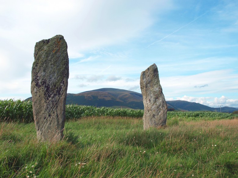
As you see the kist slab also had cups on – perhaps the prima-face marks – which would undoubtedly made a noise when made, but it was the shape of the cups on the ringing stone that struck me and sent my mind wandering back to the stone I had recently dug at the stone circle known as Long Meg and Her Daughters in Cumbria (although there is a fine circle at Stanton Drew also!).

Long Meg excavation 050


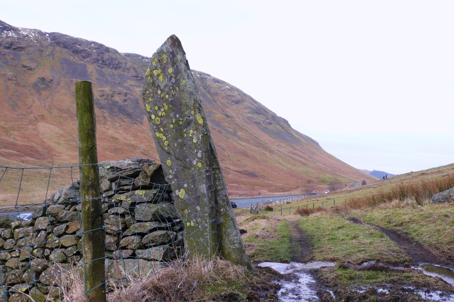
Now , although straying somewhat from the subject of upland  archaeology – it is in an elevated situation and commands a wide vista – this collapsed stone made up part of the the circle here, built on the earlier ditch of the ?Neolithic enclosure. The top end of this rock had a large smooth rounded hollow on its underside, a natural feature formed from a solution hollow?

Long Meg excavation 029

When its presumed base was uncovered there was a cup-mark, or two? Now there was inevitable debate as to whether this was also a cup mark -which came first – as they were on opposing sides and ends only one end could have been marked as it stood.

IMG_0232

Problems; so what if it was actually a reused cup marked stone or at least one end, it could even have been a “gong stone” perched on a block it would surely resonate – as demonstrated on those columnar dolerite blocks from the Precelis. Either way this particular rock was probably reused, it had a history of its own before being incorporated into the monument.

Long Meg excavation 021

So it goes on, cup-marks, found around the world yet their meaning poorly understood in prehistoric Europe. So I set about  pondering the intangible in relation to Lake District rock art and concluding the perhaps in-conclude-able; that these were memorable places well known to people partly through the creative process of cup-marking and partly through other stuff that happened there that is invisible archaeologically – to speculate is to accumulate, knowlwdge at least, appropriate perhaps in the light of recent events to paraphrase a Capitalist mantra…

Long Meg excavation 028

…oh no not again.

Pete

Acknowledgements

Thanks to the organisers of BRAG 2015, George Nash and Aron Mazel; a user friendly group of rock art individuals. The following papers are mentioned here: Paul Devereux – Winning the Cup: The problematic relationship between cup markings and lithophonic rocks; George Nash – Something Completely Different: the politics of Bedouin marks in the Negev, Southern Israel;  Cezary Mamirsky – Sardinian statue-menhirs revisited: a central Mediterranean perspective; Peter Style – Visceral places and Volcanic Voids: a consideration of Lake District rock art as ceremonial sites. The excavation at Long Meg was a community project run by Altogether Archaeology based in the North Pennine AONB and led by Paul Frodsham.

Dunmail Raise, an axial point in the Cumbrian Mountains crowned with a massive cairn, mythically associated as the burial-place of the last King of Cumbria, but variously described as a memory cairn, boundary marker between Westmoreland and Cumberland or prehistoric burial cairn. It could perhaps be all these things, yet it is now sitting ignominiously in the central reservation of the A591 which also truncates it somewhat.

Dunmail & Green Burn Survey 05.2013 190

However in the light of a recent field survey south of the pass there is a strong suggestion that it may well have prehistoric origins. Here we recorded dozens of cairns many apparently pasture clearance cairns but others more structured are perhaps more likely to be burial cairns. In particular a group near the top of the pass clustered around a large boulder in close association with the spring rises on the west side of the pass and within sight of the Dunmail Raise Cairn.

Dunmail Standing Stone, Thirlmere, Shoulthwaite encl 034

It is clear that this natural route-way dividing the Lakes – the Coniston Fault – must have seen use from prehistoric times; cup-marked rocks and a stone axe were found at the north side of this pass at Wythburn, shown above – now largely submerged. So it appears this pass was “marked” at least from the Bronze Age.

OLYMPUS DIGITAL CAMERAHistorically thee was more accessible land at the head of Thirlmere prior to the flooding of the two lakes of Leathes Water and Thirlmere by Manchester Corporation. Whose aqueduct burrows under this route, and in their wisdom the AA still maintain their phone box adjacent to Raise Cottage, the old Isolation Hospital; on a cloudy day almost as bright as a West Cork Cottage.  Surely an iconic place in the landscape!

Dunmail Standing Stone, Thirlmere, Shoulthwaite encl 014

Old mapping shows stones recorded at Dunmail Raise, which was variously written as Dunbalrase, Dunmel Raise and Dunmel Wrays, but does this refer to the cairn, lost boundary stones or even prehistoric standing stones.

speed 1611 cumb

The symbol used was synonymous with that used to describe the Three Shires Stones at the summit of Wrynose Pass where the historical counties of Cumberland, Westmoreland and Lancashire met; both shown here on John Speed’s map c.1611.

photograph

These were shown on Saxton’s 1579 map and described at the time as three small standing stones about one foot high; more recently engraved recumbent stones and the modern standing stone, erected in the nineteenth century, have been placed there. But the symbol used suggests that there may have been upright standing stones present on Dunmail Raise at the same time.

Dunmail Standing Stone, Thirlmere, Shoulthwaite encl 028

So were there ever any such standing stones on Dunmail Raise? There is certainly a naturally upright outcrop at the summit of the pass which this symbol could refer to.

Loweswater, Wythburn cups, Grasmere 026

But during the survey I noticed a tall  “gatepost” in the enclosing wall of Raise Cottage, rather unusual as it was set in line with the wall rather than at right angles, like most gate stoops. It was also apparent that this was considerably more weathered than is seen on other gate posts such as this old example bored for poles instead of a gate.

Dunmail Standing Stone, Thirlmere, Shoulthwaite encl 054

Could this be one of the stones referred to in the mapping? This had clearly been present for some time, unlike that seen next to the phone box which had been removed for safety reasons from the dividing point of the carriageway since the survey.

Dunmail Standing Stone, Thirlmere, Shoulthwaite encl 016

We shall perhaps have to keep musing on this stone, but on a recent visit it was apparent that an unfortunate accident had befallen it and now stands at half its height, not even a shadow falling from its former self on this dull day.

OLYMPUS DIGITAL CAMERA

Further up the fault-line at Castlerigg there are stones that stand in a more convincing prehistoric pattern. Elsewhere on the fringes of the Lakes there are other prehistoric standing stones like this fine pair at Kirksanton, apparently cup-marked and marking the northern moonrise and southern moonset during a major standstill every 18-19 years.

Although we must still be a little wary of pairs of stones as they may not always be what they seem. Like so many stones that stand – sometimes its just hard to say where the truth lies.

Pete

Acknowledgements and Notes: Thanks to University of Central Lancashire and The Cumberland and Westmorland Antiquarian and Archaeological Society for providing funding for the Field Survey of Dunmail Raise and Greenburn Valley. Thanks also to The Urban Prehistorian for intriguing posts, to Roaringwater Journal, and Douglas Scott for the Archaeo-astronomy information  .

Sense of Here

The knowing and feeling of place

tombjorklund.fi

Tom Björklund • Artist and Illustrator

The First Ten Words by Rich Larson

Because a guy has to keep his chops sharp

Palaeoman

Living the dream of a prehistoric human

Archaeology and Heritage Digital Recording

Low cost recording technologies

The Stone Rows of Great Britain

Big, Small, Short, Tall, Have we got 'em all?

northshorepottery

studio pottery and ceramic sculpture by Jenny Mackenzie Ross

Duddon Dig

The survey and excavation of three longhouses in the Duddon Valley

Neil's Mountains

Exploring the mountains and wild places of Britain and Ireland

Archaeology Orkney

UHI Archaeology Institute

Neolithic And Early Bronze Age Research Student Symposium

Annual Conference for Postgraduate Researchers