Archive

Prehistoric Rock Art

IMG_2946

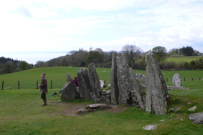
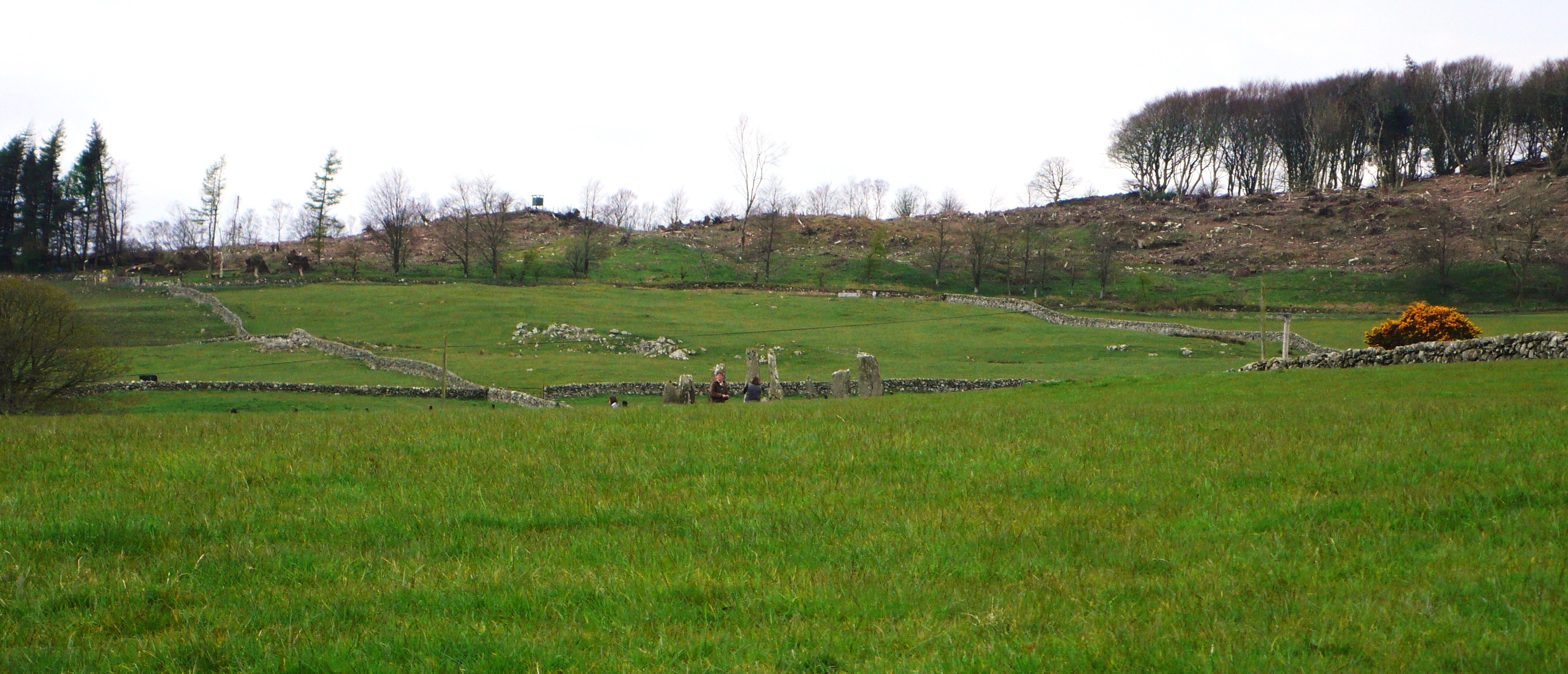
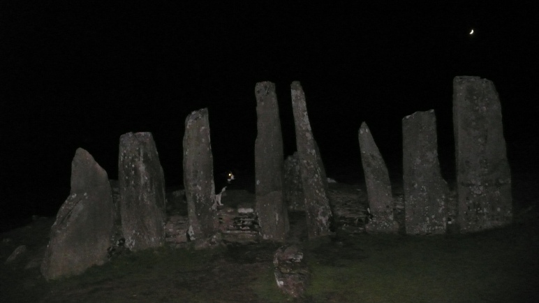
Round rings of stone on the fellside

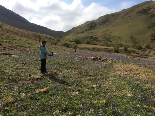
Bedded with bluebells, the ancient home

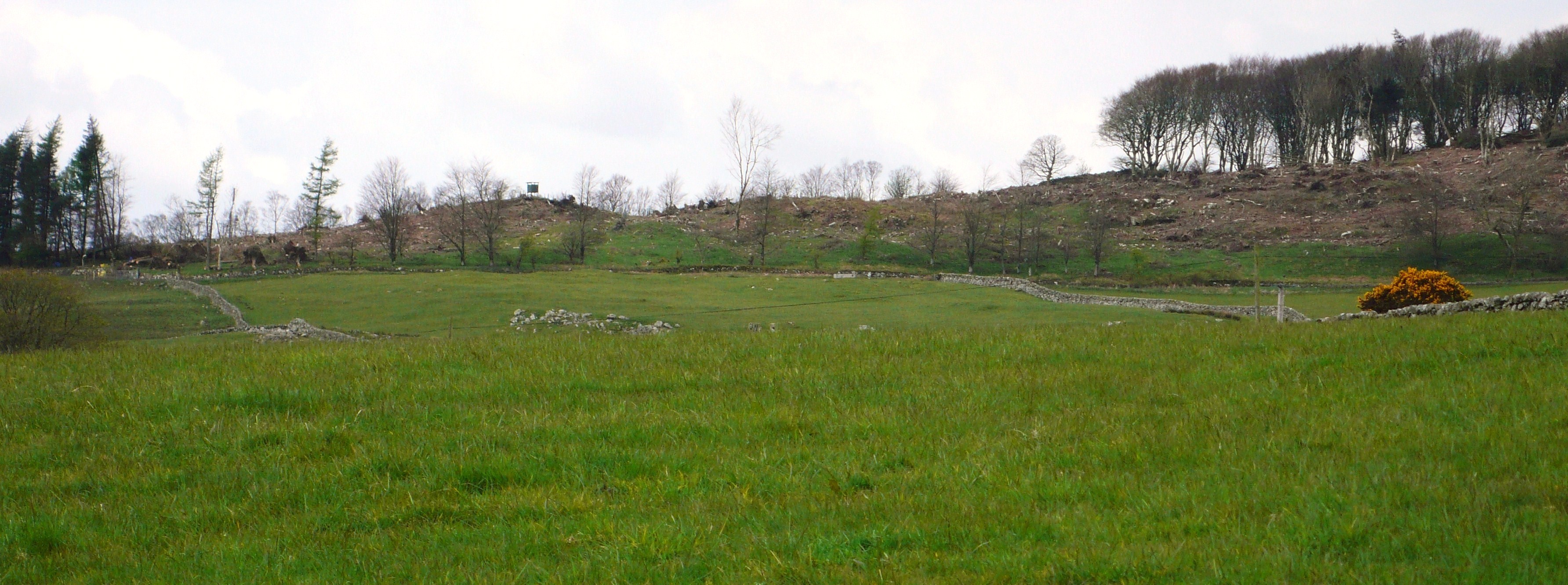
On terrace banked with rock

Pink Ennerdale Granophyre, ground round by glacier,

Dragged down from Dodds heights

Weathered to fertile soil.

IMG_2944

Now people return to the fold, above Scales Beck

The new-found steading, measured with laser and staff

Drawn with Derwent pencil

Whose core was once wadd from over the pass.

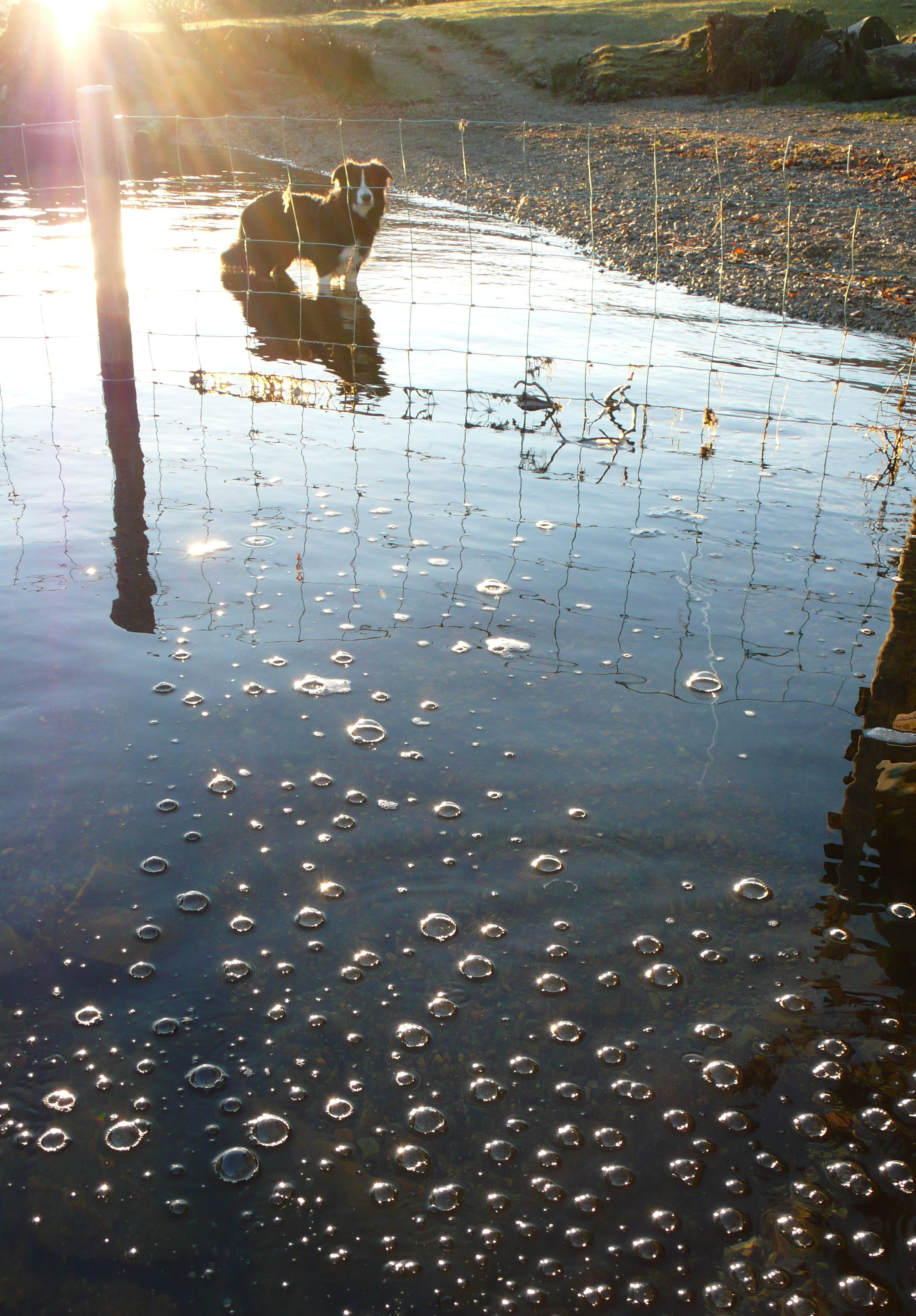
Black and white watches sheep

Where once short cattle grazed.

IMG_2949

In the shadow of Scales Knott

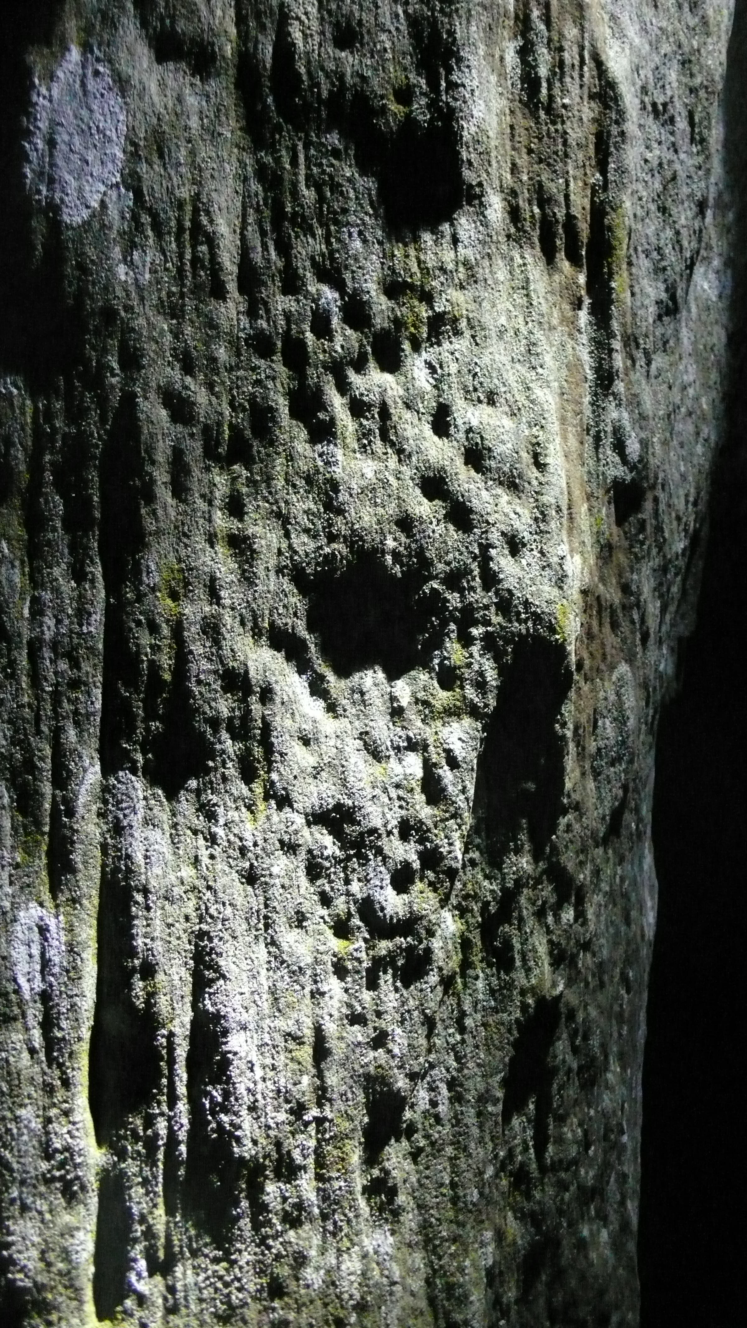
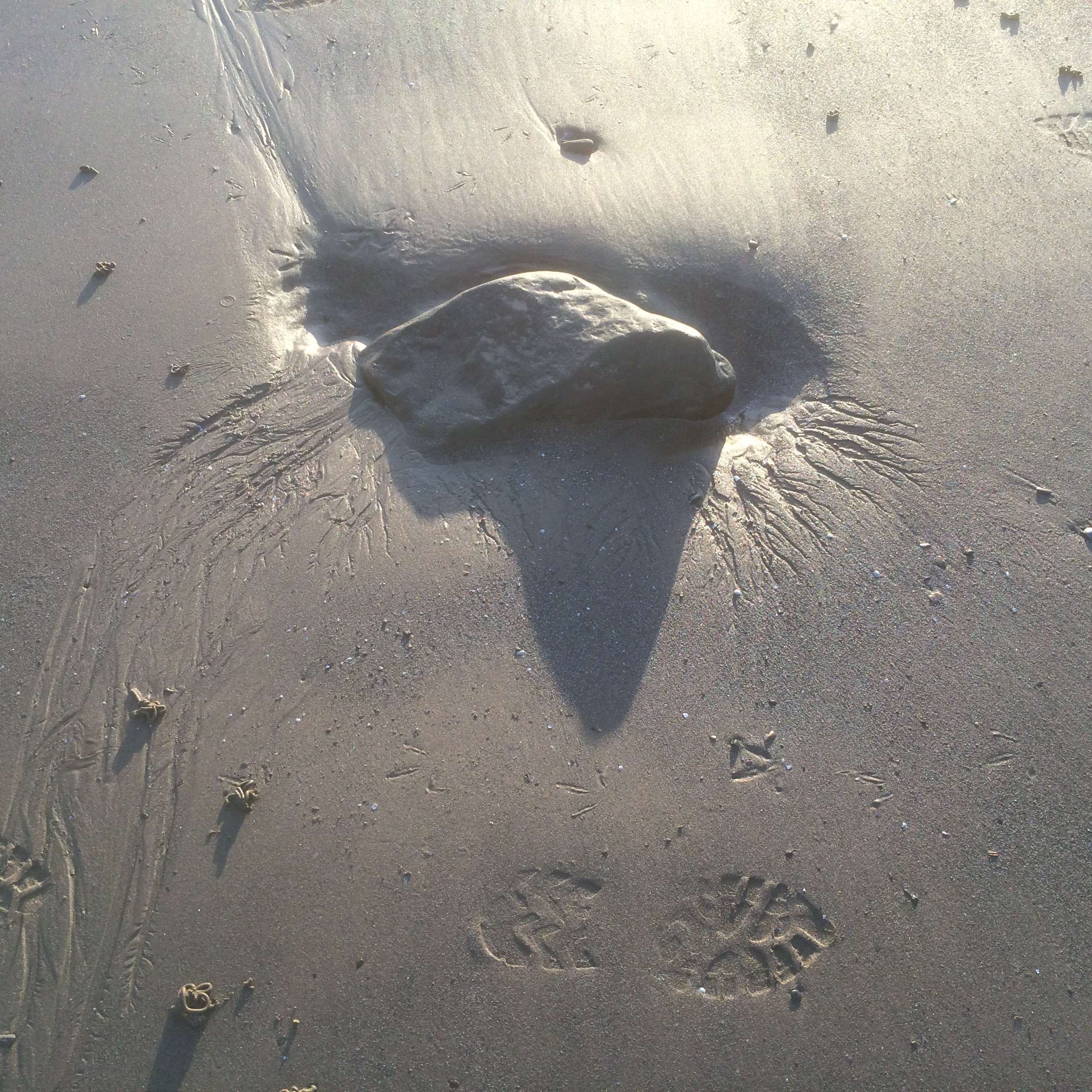
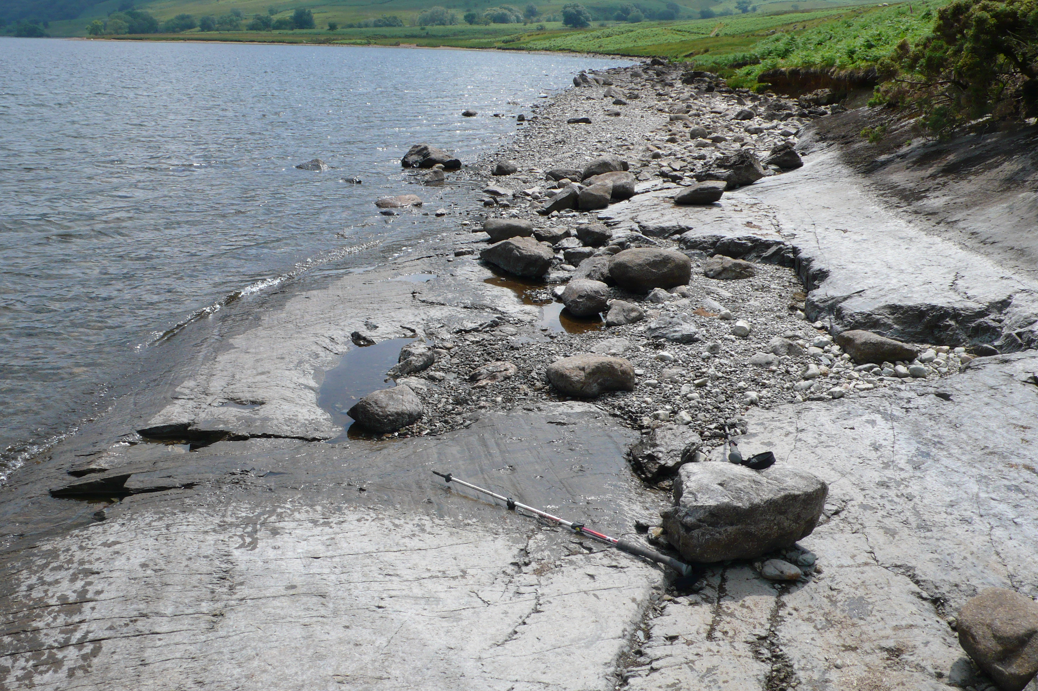
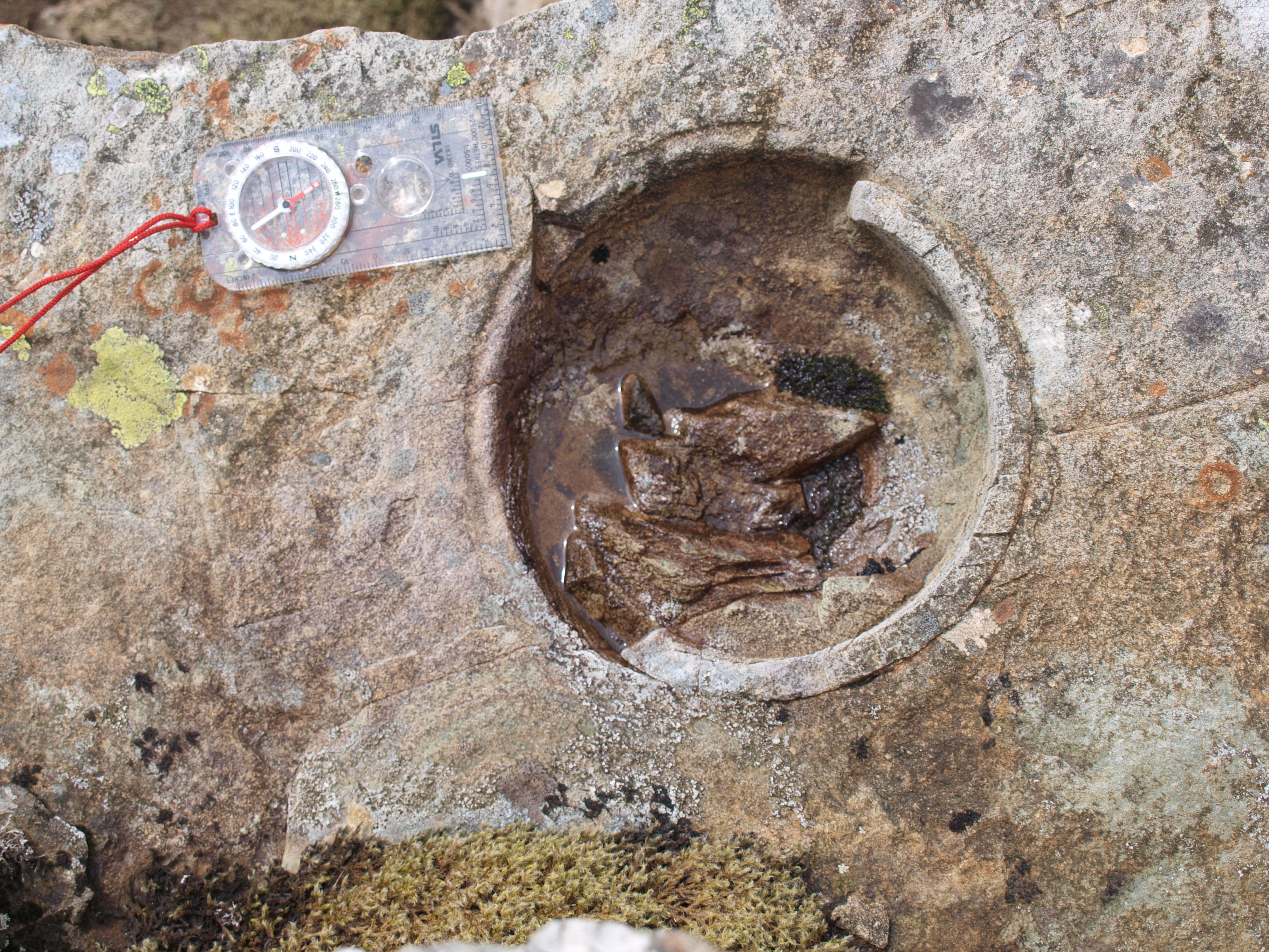
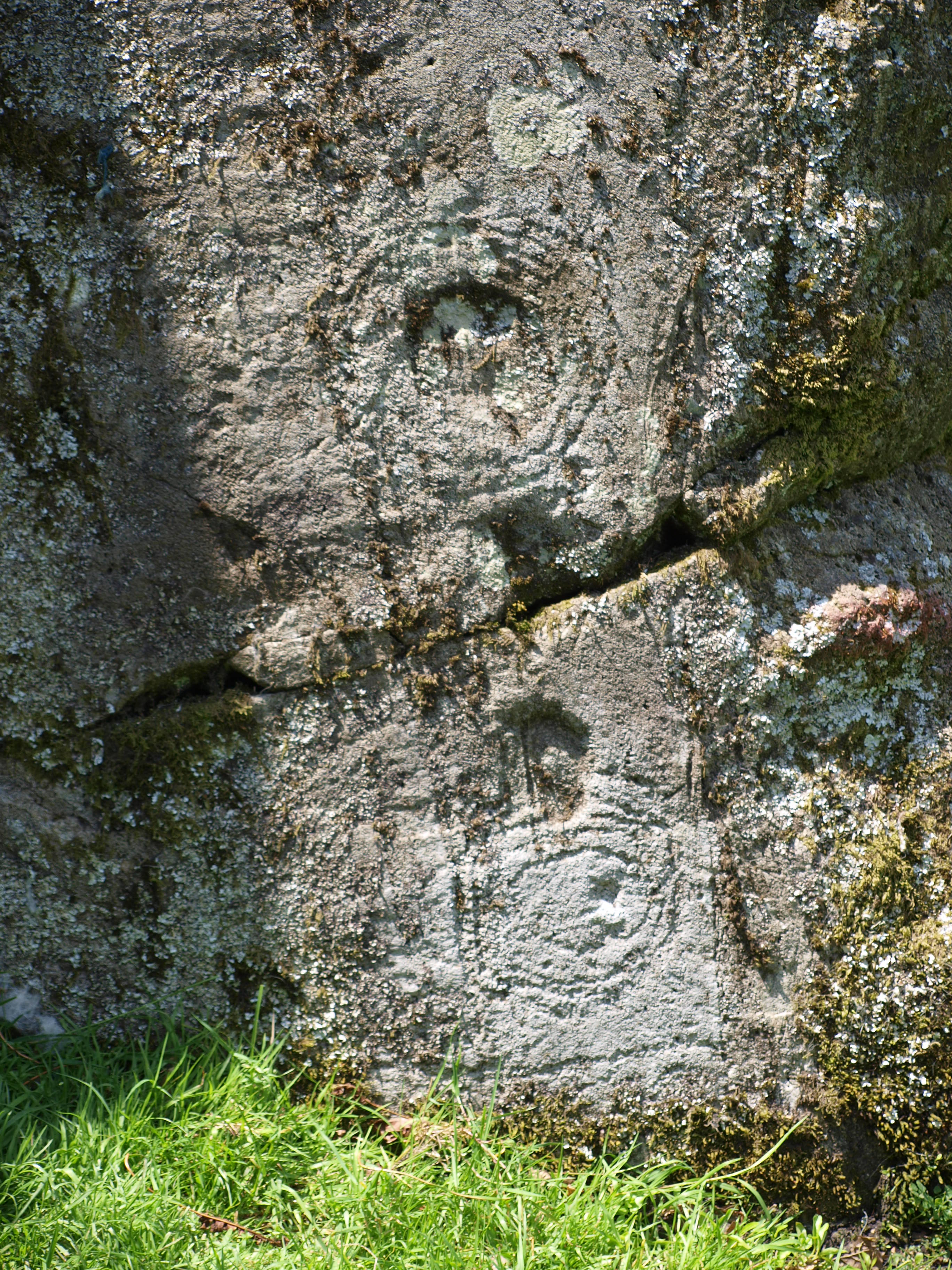
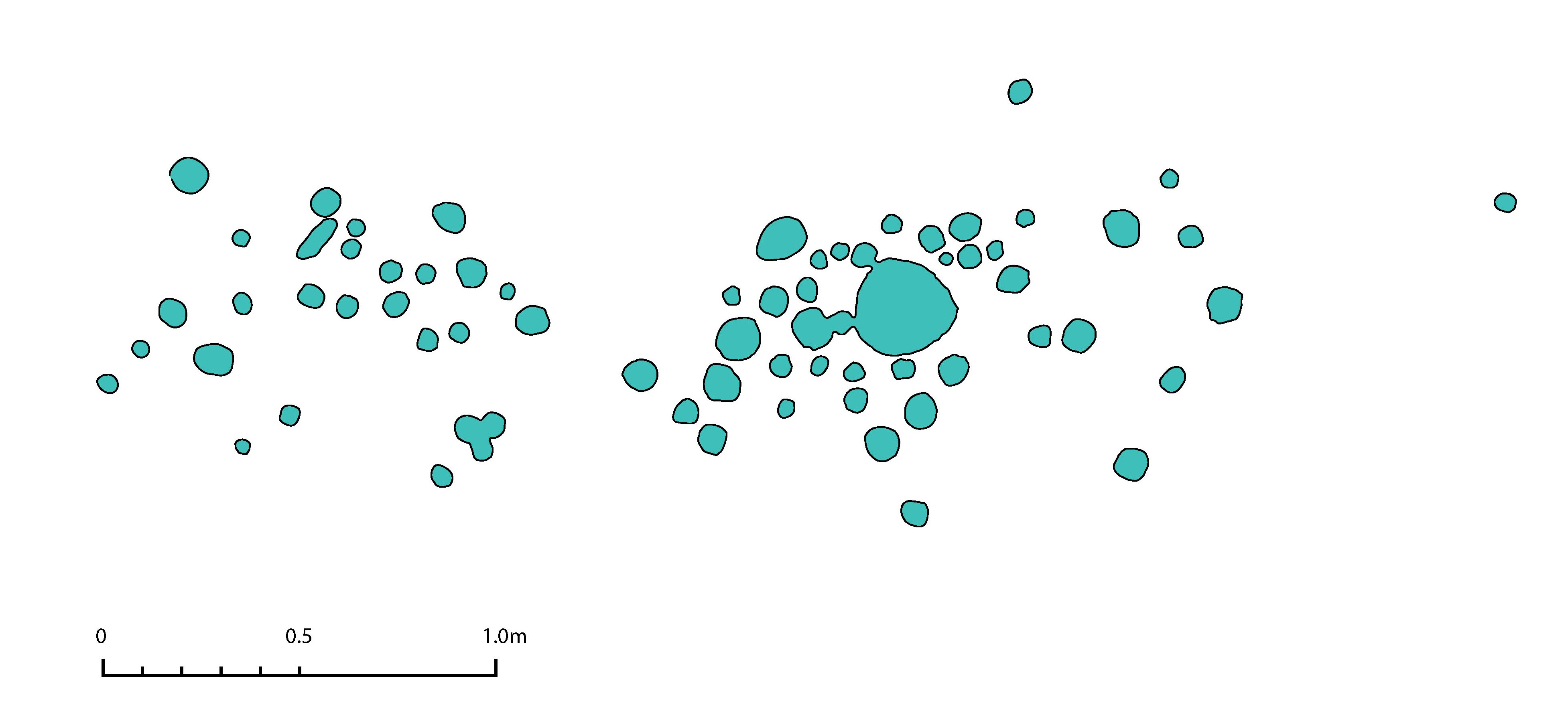
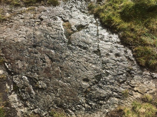
The fertile delta lies with cup-marked slab

IMG_1615

Soon peat and bracken reclaim the cairn-fields,

Just now laid bare

Before the swelling fronds

Return to cloak the land

IMG_2910

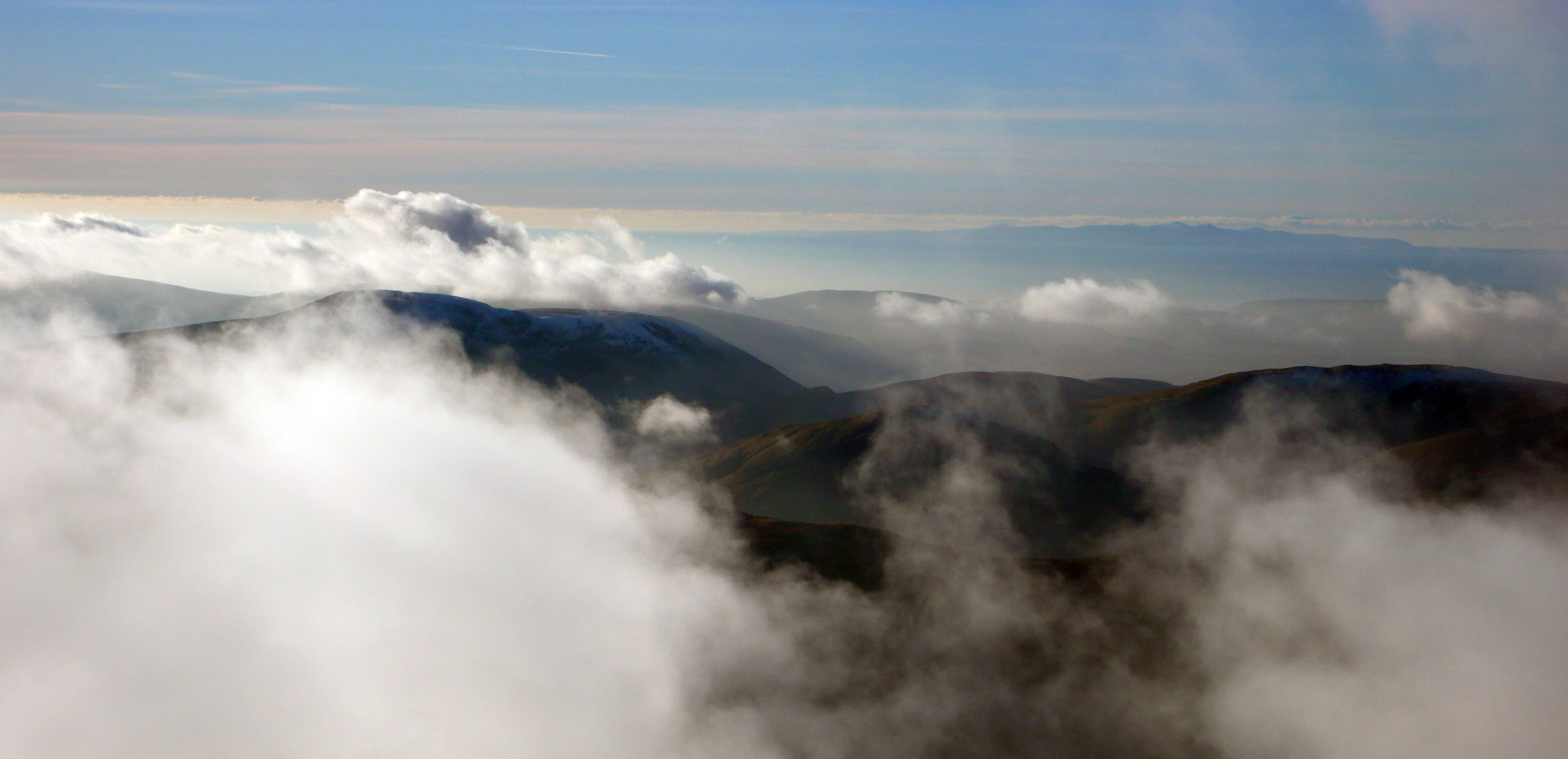
Across the lake above Rannerdale’s green fields

Whiteless Pike’s pointed pyramid

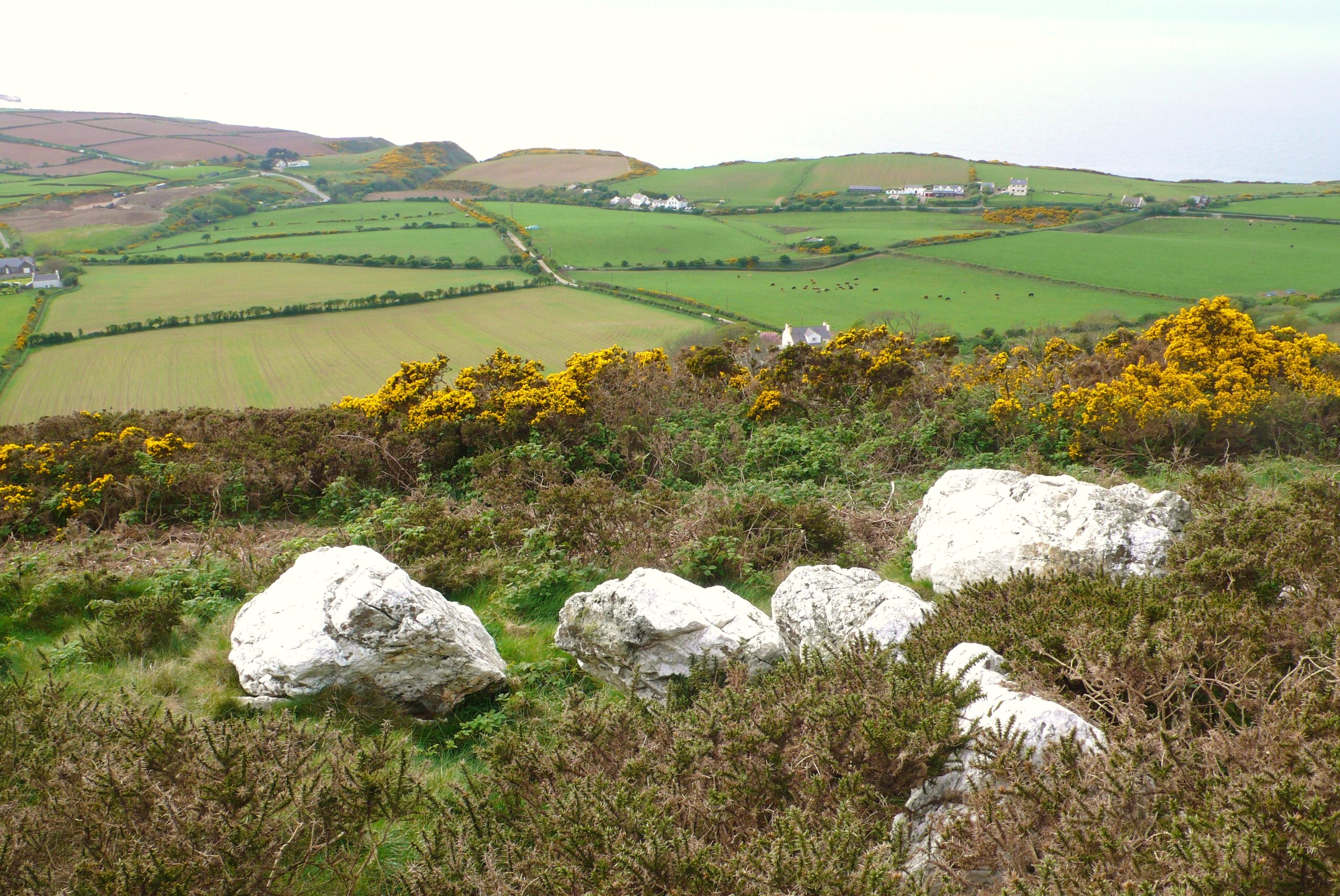
Another ancient homestead’s blue banks

IMG_2939

A squint of the eye, the lights right and they’re there

IMG_2938

Soon they grow,

Even deep enough to hide a dog

IMG_2937


Notes: Bluebells seem to like prehistoric settlements! The complex settlement features at Scales Beck cover a broad chronology and the recent discoveries of hut circles and a cup marked slab would suggest  that this stretches back at least to the later prehistoric period. Amongst the the numerous features are cairn-fields and post medieval farmsteads and a series of rectangular “bothy” or shieling structures which surround but are discrete the core settlement site on the delta. The latest phase of settlement was first noted in  1936 by Nicolas Size and recorded more fully by Thomas Hey in 1945 who considered some of the features to be “Native British” in origin, these can be seen in the Transactions of the Cumberland and Westmorland Antiquarian and Archaeological Society . The more enclosed nature of the settlement at Rannerdale also suggests that this is a later prehistoric feature although it was previously considered to be a later deserted settlement. Both these structures have now been surveyed by the Lake District National Park Archaeology Volunteers to whom thanks are due, out in all weathers, fine and not so good.

IMG_2962


“Cairnholy Joe” – a man on a mission; to enlighten visitors to the eponymous chambered cairn so that they might understand the meaning of this “monument”. Now this is not a conventional view purely based on the archaeology – way too prosaic – much more than that it is an aesthetic view of the world seen through the lens of the remains of this most architectural of prehistoric structures. Now there are many simple yet impressive Neolithic structures around the country but not many people seem to spend so much time observing the world from one such place these days.

Christening, D & G 012

It seems many people you meet who have visited here also encountered this aesthete whose name it turns out is Joseph Proskauer who describes him self on his blog as: “Lives with his wife and many other creatures, slightly below the surface of earth, toward the point where the sun sets in the dark days of winter – as seen from Cairn Holy.” Unravelling the mysteries of Cairnholy appears to be his destiny. He has studied in infinite detail the relationships between the stones and solar and lunar alignments so that the eight standing stones of the forecourt perform as some sort of complex sundial fulfilling the necessary calendrical functions  and spiritual insights of the Neolithic people who constructed it.

After some interesting discussions around the subjects I was advised to cross the neighbouring field where a dead straight path had been worn, presumably by himself and his “pupils” (or was it Alfred Watkins Old Straight Track!), and approach the forecourt and observe – this is how it looked.

Christening, D & G 013

Christening, D & G 014

Christening, D & G 016

Christening, D & G 017

Christening, D & G 018

Christening, D & G 010

Now being one who is interested in the relationship of prehistoric archaeology has to  landscape I noted that it appeared that the focus of the structure from this direction was one of two rounded hillocks on the skyline; perhaps echoing the female form. Wrong! I should have been observing the stones – in particular;  that whilst the four stones on left hand side of the forecourt curved in a slight arc those on the right were straight, but also the three outside stones of each side both rise to the right (north). These are certainly intriguing observations although I was not paying enough attention at the time to remember the import of this piece of the jigsaw.

Christening, D & G 009

Of course there were many other observations Joe made including the unrecorded weathered  pecked area of rock and cup mark on the edge of one of the southerly orthostats.

OLYMPUS DIGITAL CAMERA

Virtually invisible when the sun is high but on return to the stones in darkness and controlled lighting it came alive.

Christening, D & G 195

In darkness my own senses were heightened, as peoples must have been in prehistory when viewed at night – the stone would be seen to dance in the firelight – hearths were found in the forecourt when the site was dug by Stuart Piggott and T G E Powell, whose report can be seen here.

Christening, D & G 200

Moon dog stones!

Although Piggot and Powell found a cup and ring marked slab placed in the chamber along with a slab disturbed from the cairn marked with cup and rings they missed this marking of the facade stone. We can pehaps only speculate when this mark was made as it was likely that the walling between the orthostats would have covered this mark when the structure was first built. This is one of the rare occurrences when cup and ring marked rocks are found within a chambered cairn the other notable example being in Dallaides Long Cairn, also a rare piece of burnt jadeite axe from the Italian Alps was found here.

OLYMPUS DIGITAL CAMERA

So people have been doing pretty strange things here for millenia. On reflection despite Joe’s apparent disinterest in the factual elements of the archaeologists excavations and his apparent oversight that the reconstruction of the facade sixty five years ago means that it is most likely that it was not as we see it today when it was first built. His reconstructions of the points of the stones with clay may also be speculative but we can perhaps never be sure that it was not so and that the things he sees in this structure are as not valid as the interpretations put upon these most architectural of structures by archaeologists. Maybe it is as important how these structures feed back to modern people, be they believers in Neo-paganism, Wicca or Witchcraft,  Earth Gods or Goddess’, any of the more mainstream religions or combinations of any or all of these. Who knows if it was not always the case that from their inception people have drawn different inspirations or energies from these places.

OLYMPUS DIGITAL CAMERA

Acknowledgements and Notes; Thanks to Joseph for stimulating conversation! I was reminded of my meeting with Joe after seeing a blog by Upland Pete on Cairn holy. These meetings came about from a cottage rented below Cairnholy in 2012 and occupied by three archaeologists (rock art fiends) a story teller and an architect, thanks Kate, Tertia, Debbie and Anthony.

Pete

“…round and round…” Well I am not sure that it was rock art doodles that the 1980’s songstress Belinda Carlisle was referring to or whether she  was an enthusiastic rock art hound and despite her name she was probably not from Cumbria.

Circles in the Sand 007

However, out here on the sand there are no boundaries limitless space with far horizons leading the eye to distant lands and letting the mind wander. An inspiring place a blank canvas – moved by  to leave a mark – perhaps the same feeling as that which drove prehistoric man, on finding a smooth tactile rounded slab to peck some cups into into its surface.

Circles in the Sand 013

Seen across the Solway Firth distant Dumfries and Galloway, hilly territories marked with cups and rings. Perhaps travelers from Ireland across the sea, to this island in Neolithic times following the coast and estuaries, eventually making their way up to Eden. But here in the Cumbrian Mountains the cups have no such rings, another tribe, another time – the cup makers?

Christening, D & G 227

The small depressions where razor clams live starts things off – a pleasing pastime engrossing and mesmerising, had it been a warmer evening there might have been many more.

Circles in the Sand 016

The casts of worms and hollow of clam guiding gatherers to what lies beneath this surface,

From present to prehistoric, people have wandered these strands – searching.

Circles in the Sand 018

The foot print, a temporary mnemonic of people’s passing.

Circles in the Sand 031

Walking, back in time, from three million years

Laetoli, Tanzania to Formby Point, Lancashire,

Nearer in time and place.

Circles in the Sand 038

Wildfowl tread lightly, tiptoeing across the sand, more food for hunters past.

Circles in the Sand 024

In the distance, shingle banks, source of flint to tip their fowling arrows.

Circles in the Sand 009

To the tidal rhythm of the moon, time seems more fluid here, like the sculpted waves transiently formed in crunchy crystaline sand.

Circles in the Sand 025

 Patterns, inspiring prehistoric minds, changing forms from lozenge

Circles in the Sand 019

To rivulets returning to the sea.

Circles in the Sand 029

On shingle banks polished pebbles, rolled round.

Isle of Man 219

Amongst them, set silicate – flint from the sea floor.

 Isle of Man 109

Collect the colours, toffee to purple to grey to black.

 Isle of Man 230

Find an anvil and knap; whack – shatter.

Isle of Man 233

Random razor sharp edges and crushed dust,

Isle of Man 234

The prize, find the keenest edge, thinnest blade; the blacks brittle, toffee’s the sweetest.

Isle of Man 224

Whats left – a cup!

Circles in the Sand 039

A bird wanders off, no arrows here today

 Circles in the Sand 037

Pete

Notes

The ancient footprints made in soft esturine silt or mud that hardened and was covered over with further sediments have now been identified in several places in Britain and across the world the most famous of which  were the Laetoli footprints, over 3 million years old and discovered by Mary Leaky.

There are doubtless many reasons and uses of what have become known a portable cup marked cobbles, but the finding of “anvil stones” in seashore contexts leads one to the conclusion that these were part of the primary seashore knapping process; like this one found by Morcambe Bay Archaeology Society. Other examples can be found in the Transactions of the Cumberland and Westmorland Antiquarian and Archaeological society.

MAG lithics 031

…in modern times walk unto the West Country’s fair city of Bristol, our footsteps echoing off the soft-light-brown-sugar sandstone buildings,  Georgian elegance,  reflecting its rich history and not so sweet past of wealth built on slavers. But times have changed in this vibrant cosmopolitan city, we were here for the annual British Rock Art Group (BRAG) Conference in the finely crafted University buildings – not as old as they look.

IMG_0352

Now exotic feet figured in stone found on Stellae in Sardinia which were spoken of here, but  these red fellows are homegrown from a cist slab in Somerset which now resides  in the kids play area in Bristol Museum… feet feature quite a lot in rock art too…from Scandinavia to Scotland where the early Kings of Alba were crowned at Dunadd; stood in stone carved footprints of their ancestors.

IMG_0350

But this being Bristol, there were connections drawn between rock art, superimposition and graffiti in Bedouin culture, so it was inevitable that local lad Banksy got a mention.

IMG_0343

Listening to sounds – lithophonics to be precise – the well known (at least on Tiree) Balaphetrish Gong Stone was rung, you can see this here, and since I am intrigued by this subject in relation to Cumbrian cup-marks and have banged-on about this before (see here) I listened intently to rocks being knocked – well it was a rock art conference after all.

IMG_0351

As you see the kist slab also had cups on – perhaps the prima-face marks – which would undoubtedly made a noise when made, but it was the shape of the cups on the ringing stone that struck me and sent my mind wandering back to the stone I had recently dug at the stone circle known as Long Meg and Her Daughters in Cumbria (although there is a fine circle at Stanton Drew also!).

Long Meg excavation 050


Now , although straying somewhat from the subject of upland  archaeology – it is in an elevated situation and commands a wide vista – this collapsed stone made up part of the the circle here, built on the earlier ditch of the ?Neolithic enclosure. The top end of this rock had a large smooth rounded hollow on its underside, a natural feature formed from a solution hollow?

Long Meg excavation 029

When its presumed base was uncovered there was a cup-mark, or two? Now there was inevitable debate as to whether this was also a cup mark -which came first – as they were on opposing sides and ends only one end could have been marked as it stood.

IMG_0232

Problems; so what if it was actually a reused cup marked stone or at least one end, it could even have been a “gong stone” perched on a block it would surely resonate – as demonstrated on those columnar dolerite blocks from the Precelis. Either way this particular rock was probably reused, it had a history of its own before being incorporated into the monument.

Long Meg excavation 021

So it goes on, cup-marks, found around the world yet their meaning poorly understood in prehistoric Europe. So I set about  pondering the intangible in relation to Lake District rock art and concluding the perhaps in-conclude-able; that these were memorable places well known to people partly through the creative process of cup-marking and partly through other stuff that happened there that is invisible archaeologically – to speculate is to accumulate, knowlwdge at least, appropriate perhaps in the light of recent events to paraphrase a Capitalist mantra…

Long Meg excavation 028

…oh no not again.

Pete

Acknowledgements

Thanks to the organisers of BRAG 2015, George Nash and Aron Mazel; a user friendly group of rock art individuals. The following papers are mentioned here: Paul Devereux – Winning the Cup: The problematic relationship between cup markings and lithophonic rocks; George Nash – Something Completely Different: the politics of Bedouin marks in the Negev, Southern Israel;  Cezary Mamirsky – Sardinian statue-menhirs revisited: a central Mediterranean perspective; Peter Style – Visceral places and Volcanic Voids: a consideration of Lake District rock art as ceremonial sites. The excavation at Long Meg was a community project run by Altogether Archaeology based in the North Pennine AONB and led by Paul Frodsham.

Dunmail Raise, an axial point in the Cumbrian Mountains crowned with a massive cairn, mythically associated as the burial-place of the last King of Cumbria, but variously described as a memory cairn, boundary marker between Westmoreland and Cumberland or prehistoric burial cairn. It could perhaps be all these things, yet it is now sitting ignominiously in the central reservation of the A591 which also truncates it somewhat.

Dunmail & Green Burn Survey 05.2013 190

However in the light of a recent field survey south of the pass there is a strong suggestion that it may well have prehistoric origins. Here we recorded dozens of cairns many apparently pasture clearance cairns but others more structured are perhaps more likely to be burial cairns. In particular a group near the top of the pass clustered around a large boulder in close association with the spring rises on the west side of the pass and within sight of the Dunmail Raise Cairn.

Dunmail Standing Stone, Thirlmere, Shoulthwaite encl 034

It is clear that this natural route-way dividing the Lakes – the Coniston Fault – must have seen use from prehistoric times; cup-marked rocks and a stone axe were found at the north side of this pass at Wythburn, shown above – now largely submerged. So it appears this pass was “marked” at least from the Bronze Age.

OLYMPUS DIGITAL CAMERAHistorically thee was more accessible land at the head of Thirlmere prior to the flooding of the two lakes of Leathes Water and Thirlmere by Manchester Corporation. Whose aqueduct burrows under this route, and in their wisdom the AA still maintain their phone box adjacent to Raise Cottage, the old Isolation Hospital; on a cloudy day almost as bright as a West Cork Cottage.  Surely an iconic place in the landscape!

Dunmail Standing Stone, Thirlmere, Shoulthwaite encl 014

Old mapping shows stones recorded at Dunmail Raise, which was variously written as Dunbalrase, Dunmel Raise and Dunmel Wrays, but does this refer to the cairn, lost boundary stones or even prehistoric standing stones.

speed 1611 cumb

The symbol used was synonymous with that used to describe the Three Shires Stones at the summit of Wrynose Pass where the historical counties of Cumberland, Westmoreland and Lancashire met; both shown here on John Speed’s map c.1611.

photograph

These were shown on Saxton’s 1579 map and described at the time as three small standing stones about one foot high; more recently engraved recumbent stones and the modern standing stone, erected in the nineteenth century, have been placed there. But the symbol used suggests that there may have been upright standing stones present on Dunmail Raise at the same time.

Dunmail Standing Stone, Thirlmere, Shoulthwaite encl 028

So were there ever any such standing stones on Dunmail Raise? There is certainly a naturally upright outcrop at the summit of the pass which this symbol could refer to.

Loweswater, Wythburn cups, Grasmere 026

But during the survey I noticed a tall  “gatepost” in the enclosing wall of Raise Cottage, rather unusual as it was set in line with the wall rather than at right angles, like most gate stoops. It was also apparent that this was considerably more weathered than is seen on other gate posts such as this old example bored for poles instead of a gate.

Dunmail Standing Stone, Thirlmere, Shoulthwaite encl 054

Could this be one of the stones referred to in the mapping? This had clearly been present for some time, unlike that seen next to the phone box which had been removed for safety reasons from the dividing point of the carriageway since the survey.

Dunmail Standing Stone, Thirlmere, Shoulthwaite encl 016

We shall perhaps have to keep musing on this stone, but on a recent visit it was apparent that an unfortunate accident had befallen it and now stands at half its height, not even a shadow falling from its former self on this dull day.

OLYMPUS DIGITAL CAMERA

Further up the fault-line at Castlerigg there are stones that stand in a more convincing prehistoric pattern. Elsewhere on the fringes of the Lakes there are other prehistoric standing stones like this fine pair at Kirksanton, apparently cup-marked and marking the northern moonrise and southern moonset during a major standstill every 18-19 years.

Although we must still be a little wary of pairs of stones as they may not always be what they seem. Like so many stones that stand – sometimes its just hard to say where the truth lies.

Pete

Acknowledgements and Notes: Thanks to University of Central Lancashire and The Cumberland and Westmorland Antiquarian and Archaeological Society for providing funding for the Field Survey of Dunmail Raise and Greenburn Valley. Thanks also to The Urban Prehistorian for intriguing posts, to Roaringwater Journal, and Douglas Scott for the Archaeo-astronomy information  .

No, not some Mad Hatter-esque question posed at an eccentric tea party in Grasmere, but a serious question that concerns all prehistoric rock art/cup mark researchers. Unlike this picture, today in the Cumbrian Fells this question would be hard to address with a light dusting of snow – the dormice are, well dozing, however the low sun at this time of year is possibly the best opportunity to consider the problem.

Whorny Side cairn 086

“Sun Cup” Loweswater

This came to mind following a field trip to look at some recently reported rock art sites. Among these was a single cup at the top edge of a fine glaciated slab on the side of the valley just above Crummock Water, a site I feel, had it been in Scandinavia would have been covered with ritual carvings of Bronze Age boats or perhaps further north, reindeer.

Buttermere rock art field trip 019

“Cup-marked” glaciated slab, Crummock Water

But this “cup” appeared to sit in splendid isolation in a setting that was somewhat atypical for the locale.

Buttermere rock art field trip 018

Solitary”cup-mark” Crummock Water

It’s base also had a hump, now this in itself does not disqualify it from being a man-made cup, a row of four at Buttermere we had agreed earlier were cups were of rougher manufacture than we expect to see normally, so it could be. But, having previously observed the lower usually submerged slab, when the lake level had dropped considerably a few years ago, it was obvious there were marks that had been plucked out by the glacial action rather than pecked by man. Had these marks been exposed to the elements for many millennia they may well have eroded into what we could see as the single cup mark above. Likewise the four we saw earlier may have eroded smoother had they been on a level rather than sloping surface

Crummock slabs, Ling Crag; Dodd Cairn; Gale Fell; Gable moonrise 016

Glaciated slab, Crummock Water, glacial “plucks” just above pole

So what other criteria do we consider are appropriate to test the veracity of a possible cup mark? One is its landscape setting,  perhaps a little thorny as there are inevitably always exceptions, however we can say with a certain amount of confidence at present that the majority of the sites here are on glaciated bedrock, often roche moutonnée.

Confusingly one of the first sites to be identified in the Lake District on the Langdale Boulders is now appears to be an anomalous site within the region and is surrounded by cupule of natural origin

Allen banks, crummock cups, Castlerigg 022

Eroded clasts, Great Langdale

So what of the actual cupule? Aside from slabs whose surfaces are pitted with eroded glacial gas vesicles or eroded clasts – inclusions of softer rocks – we are left with the case of the odd cup or two that may or may not be of human origin.

Scafell Pike Axe factories 110

Eroded gas vesicles, Scafell Pike

Now a few of these individual cups are of such symmetry that they compare well to slabs where there are numerous other cup-marks.

Mitredale 054

“Cup-marked” rock, Mitredale

But some do not quite cut the mustard; this rock reported as cup marked in a survey of Mitredale has many of the attributes of natural features – eroded faults and “cups” with projecting inclusions – which should have suggested that these were natural features.

Mitredale 050

Eroded “cup” Mitredale

So back to the problem, when a cup is not a cup,  when it is an only cup…

A fine natural bowl from the summit of Haycock

A fine natural bowl from the summit of Haycock

or when it’s a bowl?

Pete


Notes: Thanks to; Jamie Lund, National Trust Archaeologist, Mark Astley, National Trust Ranger, and Tom Bell, Chester University, for discussions on these sites. If you wish to see the solitary “cup” yourself you can find it directly below LIng Crag, Crummock Water, its a fine walk, there are other sites locally that really are prehistoric cups!

Greetings to all readers for a fine 2015! – “Now is the time for fire and wine…” – its elemental…

Darkness; landscape fades, eyes are drawn to the fire cups, intimate in their rocky relief.

More Fire cups 036

Altitude; changed world – domed profile glimpsed through the notch, upturned axe blade thrust into the earth marking the spot

Grasmoor 28.12.14 007

Through the vaporous air – Isle of Man – connecting the Neolithic Irish Sea-farers

Grasmoor 28.12.14 022

Mountains mirrored in mercury water, a place for reflection and offering

Grasmoor 28.12.14 029

Light; solstice morning, winds blow, the sun hides

Windy Crummock Solstice 016

Pete

Notes and references

A  session  themed on “Fire” at the Theoretical Archaeology Group Conference at Manchester University this year reminded me of some “experiential archaeology” from a few years back;“Fire Cups” ,the consequence of some discussions with Dave Chapman around simple stone lamps from Late Upper Palaeolithic cave sites in France  which was followed by an impressive demonstration using a home pecked stone-cup-lamp, cooking oil and a plaited moss wick.

http://www.ancient-arts.org/index.html

To the best of my knowledge there is no archaeological evidence of burning within pecked cups on outcrops but this was simulated with enclosed candles. The main problem on a still evening was to get the candles to stay alight; the rock’s  elevated position meant that there were small eddies encircling the outcrop repeatedly puffing the flames out. With perseverance the effect was intriguing, like stars, an eerie sight late in the evening had anyone cast their gaze lake-wards. No cups were harmed in the making!

More on experimental “Burning The Circle” on Arran can be found on Gavin MacGregor’s blog and Northlight Heritage’s website

https://heritagelandscapecreativity.wordpress.com/2013/11/05/burning-circle/

http://northlight-heritage.co.uk/conc5/index.php/sub1/burning-circle/

Pike O’Stickle – site of Neolithic Axe-Factories – although a diminutive peak in the Cumbrian Mountains has distinctive profile which is curiously conspicuous from a broad area.

The quote is from Steve Ashley’s song “Fire and Wine”.

One benefit of enforced inactivity – over zealous mountain biking – is that you can sort through photos and reflect on previous years field work. In this case some prehistoric cup-marked rocks found in Rydal in 2010. These were spotted in January on the way to reconnoitre the upper Rydal Valley for a field survey carried out later that year. I had been targeting various glaciated slabs, mainly roche moutonnée, in the Lake District valleys for man-made cup-marks and spotted this one and took a look; this is as it appeared to me.

OLYMPUS DIGITAL CAMERA

Up to that time there were hardly a handful of cup-marked slabs known in the Lake District, one of these was Barbers Rock in Loweswater across the fields from our home (below). As children we played here and noticed the curious smoothed hollows and thought these were places where people had ground “things”; I thought little of them for several decades until I realised that child’s-eye view was not that far off and these were made by the hand of man.

OLYMPUS DIGITAL CAMERA

So the question everyone asks is invariably “what do they mean?” and the answer is, we don’t exactly know, but we could have a stab at it. Ronald Morris proposed 104 uses for rock art in his book on the rock art of Galloway and this highlights the sometimes speculative nature of the search for meaning in abstract petroglyphs; which were in use for over 1000 years from the Later Neolithic to Bronze Age. But perhaps they give some insight into the cultural references of the time; inspirations revolving around relationships with landscape, the natural environment and their nascent agricultural practices.

OLYMPUS DIGITAL CAMERA

So to throw a few thoughts out there, we see similar rock markings, caused by erosive processes such as natural cups and here at the entrance to Great Langdale rock ripples.

Caithness 125

Water, fundamental, ubiquitous – ripples – reflections – motion

Rock art at Great Langdale

Rock art at Great Langdale

Quartz  – triboluminescence, glowing when struck together – hammerstones used in cup-making at Kilmartin Glen, Argyll.

Quartz "stone circle" Isle of Man

Giants Fingers the extraordinary remains of a quartz stone circle, Isle of Man

Society probably had vestigial animistic belief structures at the time, so carving on the “living rock” would have had great significance and likely a good deal of ritual associated with it. Was the action of rock-marking perhaps more significant than the end result; a statement of belonging to that spot? A mnemonic for death; the proximity of cairns in some cases could suggest this or were the meanings of marked-places to prehistoric people also multi-facetted?

Rydal High Park CM Plan

But as I start to digitise the most recent finds from the Lake District (above) I am reminded of this picture…

barrow mus-xmas 08 050

…no not Floss!

Pete

Sources

You can read the 104 varieties of rock art in The Prehistoric Rock Art of Galloway and the Isle of Man by Ronald W. B. Morris and they are not all fanciful.

Thanks to Kate Sharpe whose Doctoral Thesis gave some inspiration to look for rock art sites in the Lakes:  Motifs, Monuments and Mountains: Prehistoric Rock Art in the Cumbrian Landscape online at: http://ethos.bl.uk/OrderDetails.do;jsessionid=00502FD1F652A65EEDD012FECB272D99?did=1&uin=uk.bl.ethos.525624

Visualisations and other integrated archaeological artistic endeavours are shown on Aaron Watson and collaborators website: http://www.monumental.uk.com/photography/

Excavations around rock art sites and the associated use of quartz are discussed in: An Animate Landscape: Rock Art and the Prehistory of Kilmartin, Argyll, Scotland by Andy Jones et al.

Sense of Here

The knowing and feeling of place

tombjorklund.fi

Tom Björklund • Artist and Illustrator

The First Ten Words by Rich Larson

Because a guy has to keep his chops sharp

Palaeoman

Living the dream of a prehistoric human

Archaeology and Heritage Digital Recording

Low cost recording technologies

The Stone Rows of Great Britain

Big, Small, Short, Tall, Have we got 'em all?

northshorepottery

studio pottery and ceramic sculpture by Jenny Mackenzie Ross

Duddon Dig

The survey and excavation of three longhouses in the Duddon Valley

Neil's Mountains

Exploring the mountains and wild places of Britain and Ireland

Archaeology Orkney

UHI Archaeology Institute

Neolithic And Early Bronze Age Research Student Symposium

Annual Conference for Postgraduate Researchers