Archive

Tag Archives: Cumbria

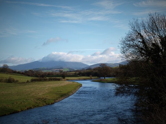
Beneath the ochrous clay banks the Derwent River flows

over salmon spawning glacial gravels,

meandering from mountain to sea

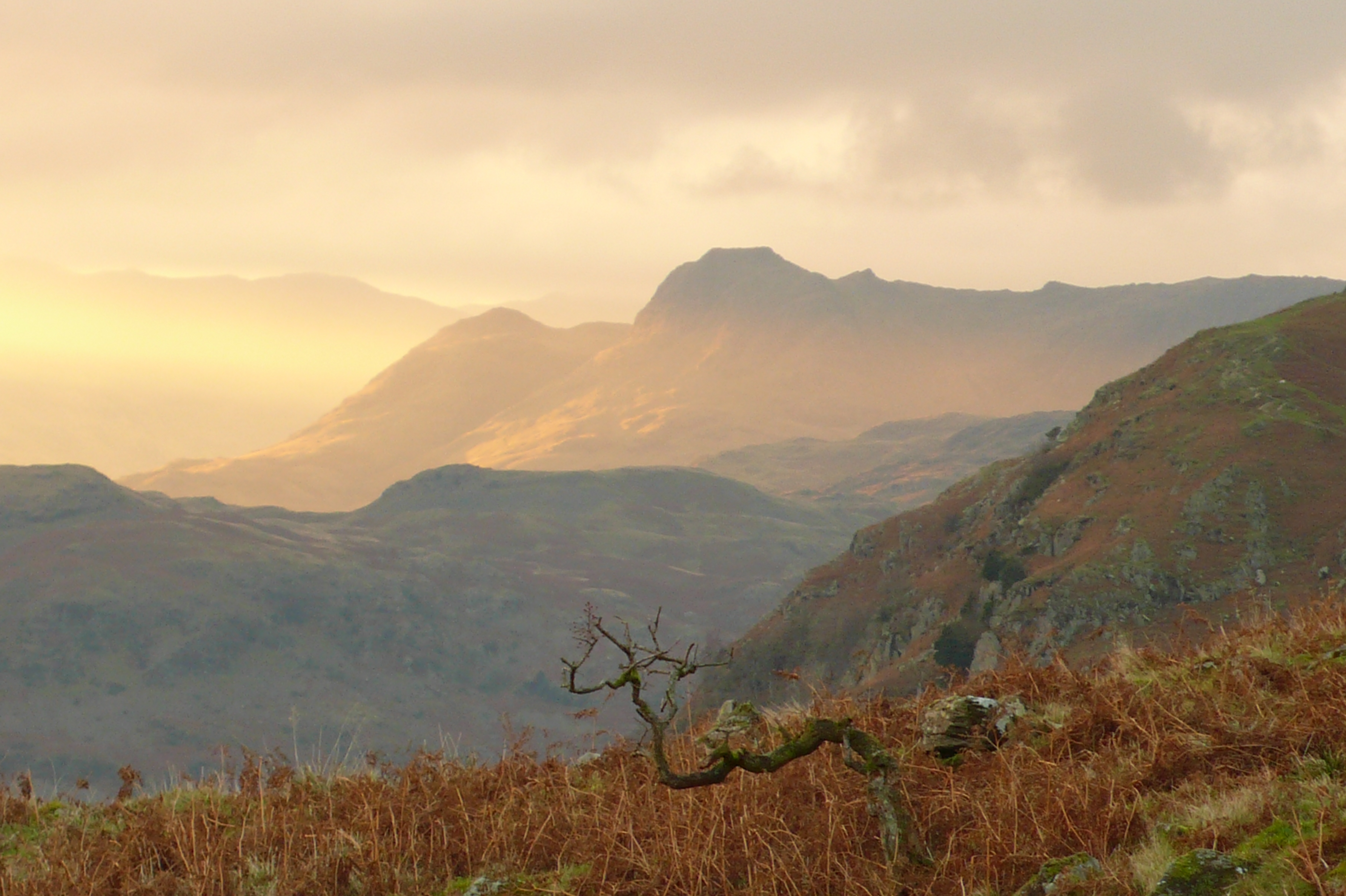
draining distant Skiddaw’s icy

cloud capped slatey slopes.

OLYMPUS DIGITAL CAMERA

A horned oxbow curls round the plain’s rim,

distant memories rise, first settlers;

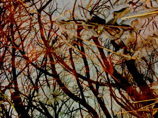
moonlit shadows, fires glimmering on mercury silvered surface,

deer hide drumming, chanting, dancing;

a gathering.

OLYMPUS DIGITAL CAMERA

Ceremony in gravel banked henge;

propitious offering at waters meet,

fresh fired carinated crock of grain

cast into water,

hissing;

floats,

steams,

shatters and

settles,

returned to its riverine source,

a fragmentary moment;

precious seeds strewn,

scattered constellations on mirrored firmament.

Fire water

Ages pass;

river terrace, thatched earth roundhouse,

woollen clad Brigantian stands sentinel,

rough black dog guards the flock,

gatekeeper gazes north from a gap in the pale,

across the confluence of waters and cultures.

OLYMPUS DIGITAL CAMERA

New bridge, fecund offerings auger well,

pacify those passing south on the paved way,

borderlands, changes.

Derventio; enclosed with dressed stone walls,

rectangular Roman homes, luxuriant laconicum,

mosaic floors and painted walls.

Fine wines, exotic food, tales of distant lands,

people of many races – mills, streets and trade.

OLYMPUS DIGITAL CAMERA

New era;

now the land moves.

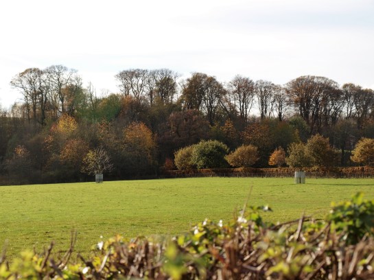
old oaks cloak the homestead,

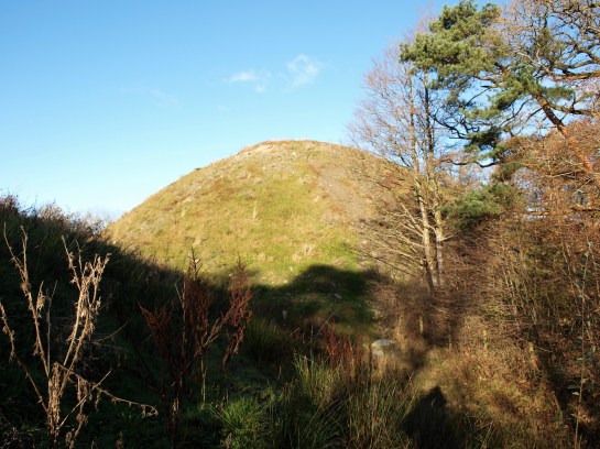
man-made mountain is raised, gateway breached,

OLYMPUS DIGITAL CAMERA


No Silbury Hill this, but

The Laureates,

leafy crown

of irony.

OLYMPUS DIGITAL CAMERA

Upheaval, promontory becomes peninsular

jutting out into sea of churned earth;

battlefield of bulldozed boulders, broken trees and mud,

surrounded by palisades of doused timber,

enclosed with walls of stone and baked clay,

tracks of black bitumen – new trails cross the domain,

no holloways here.

Over run and overlooked.

OLYMPUS DIGITAL CAMERA

River terrace mauled, dug, dragged and dumped

transformed into terraced homes.

scaffolding poles rise;

spears daring to defy the territory.

In the woods hinds scatter,

echoes of woodland industry linger;

domestic reminders.

OLYMPUS DIGITAL CAMERA

The lost shepherd gazes down the road,

bewildered, placatory bronze offering,

the flock is gone,

OLYMPUS DIGITAL CAMERA

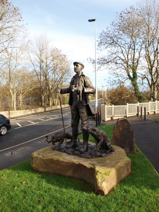
collies teeth clack at passing cars,

monument or folly,

the land has paid the price.

OLYMPUS DIGITAL CAMERA

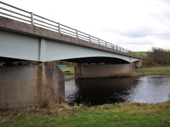
Where Roman soldiers stamped across planks

girder and concrete now flyover.

OLYMPUS DIGITAL CAMERA

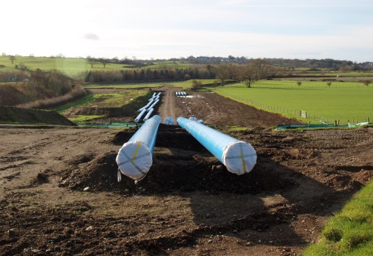
water constrained in plastic pipe,

burrows bluely to Moorside.

OLYMPUS DIGITAL CAMERA

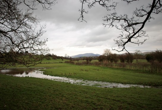
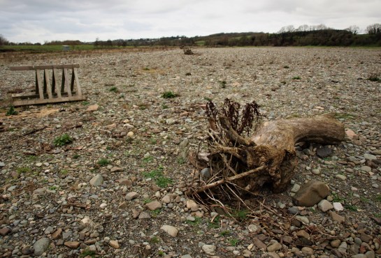
Gravelly groves in storm washed field,

Reminders of inundations,

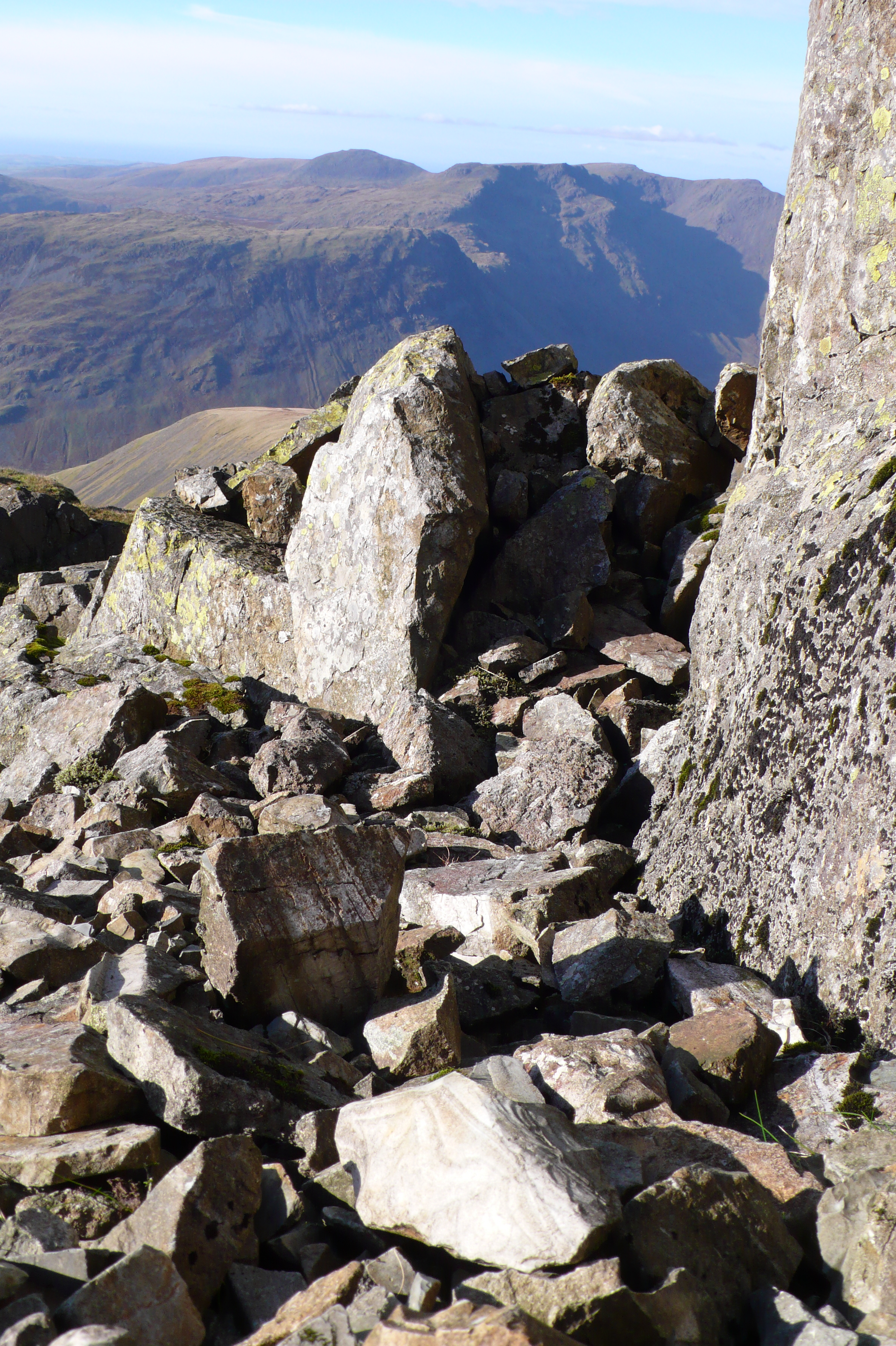
fells deforested, changing climate,

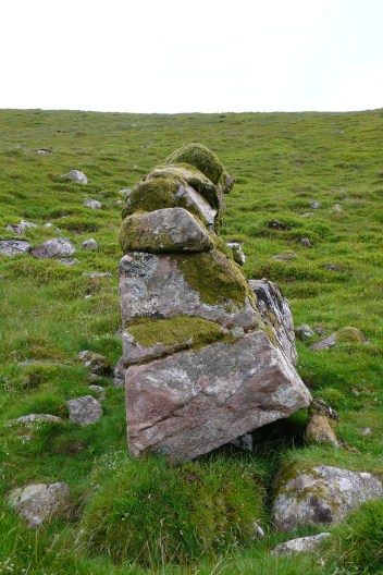
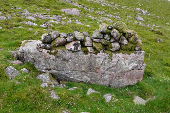
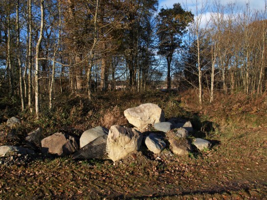
rich store for cairn builders’

long gone,

sacrifices must be made.

OLYMPUS DIGITAL CAMERA

Unseen in dark woods,

Wrapped in brick and burnt limestone,

Marooned by road and railing,

Forgotten behind the barrow,

No huggers here to embrace this hilltop homestead.

OLYMPUS DIGITAL CAMERA

Notes and acknowledgements:

Although not on such a grand scale as its better known relation, Old Oswestry Hillfort and the worthy campaign to protect it from the encroachment of housing estates, nevertheless Fitz Park settlement demonstrates what can become of our heritage when profit is put before heritage.

Whilst there is an inevitable degree of speculation in the narrative created above it is based on archaeological and historical analysis which I provide some links for below.

During archaeological evaluations prior to construction of The Laureates housing development dozens of pieces of a single Early Neolithic carinated bowl were found, dated to c.3700 BC from a grain of emmer wheat in what was interpreted as a votive offering in a former oxbow lake on the flood plain further details can be found here

Fitz Park carinated bowl

Carinated Bowl found at Fitz Park development. Archaeological Research Services Ltd, 2015

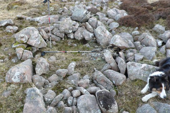
Fitz Park Settlement is a Late Prehistoric/Romano British enclosed settlement of modest proportions, which is described here. Excavations around the site failed to identify any other archaeological remains and can be seen here. The consequence of this development is that this Scheduled Ancient Monument is now surrounded on three sides by a housing development which, it appears, will come to within two metres of its earthworks, the surrounding fence was broken down.

The Roman road south to the port at Ravenglass must have passed close by the Fitz Park settlement which overlooks the likely former confluence of the rivers Cocker and Derwent, the latter was said to be recut in the 13th century to provide greater defence for Cockermouth Castle, now somewhat ironically being undermined by it and being to some extent responsible for the inundations of the modern town. It seems the Roman town was situated at the old confluence.

OLYMPUS DIGITAL CAMERA

As a consequence of the 2009 floods extensive Roman remains were discovered on the floodplain below the Roman fort of  Derventio at Papcastle opposite including a water mill. This led to the Discovering Derventio  Heritage Lottery Funded Project which can be found here. Amongst the discoveries made during subsequent surveys and excavations bathhouses and bridge buttresses along with fertility offering were found, these were mainly in the riverside fields known as Broomlands.

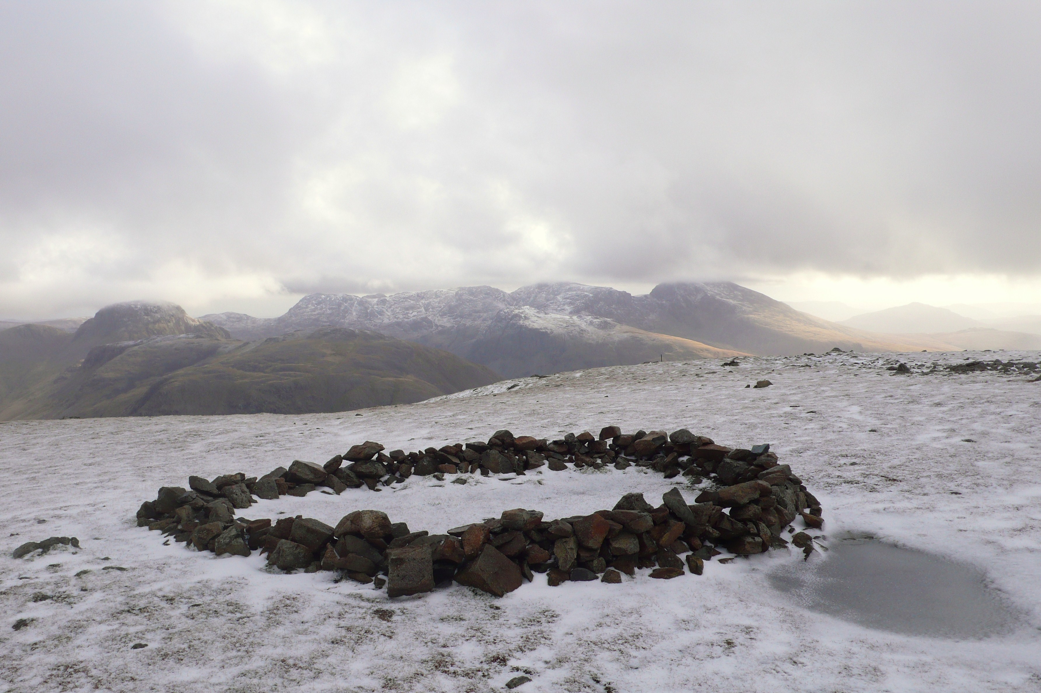
An intriguing unexplained feature was also identified in the geophysical survey here, an enigmatic sub-circular gravel and clay bank, clearly hengiform yet apparently Roman in origin and can be seen here. Whilst current interpretations suggest this is not a Neolithic henge, it is interesting none-the-less and given the siting of other henges at river confluences regionally at Mayburgh and the suggested connections with Irish henges (Bradley & Watson, 2009), it would seem quite possible there was such like here, perhaps the feature described  by Askew in his 1872 guide to Cockermouth “…in the second field on the Broughton road, on the left, there are still some remains of an amphitheatre” sadly now apparently under the bypass.

The concept of offerings in watery places to appease is undoubtedly and old one and continues to the present day and much has been written on the subject. The big blue pipeline said to be laid to protect the freshwater mussels in the River Ehen, at a cost of £300 million at last count, is actually considered locally as the unspoken secure water supply to the new Nuclear power station to be built  at Moorside.

At the other side of Cockermouth an archaeological evaluation of yet another large housing development in the town identified further evidence of prehistoric activity to the east of the River Cocker in the form of a burnt mound. Clearly there was more going on here in prehistoric times than previously thought.

Following Storm Desmond, thousands of tons of gravel were deposited again in the fields downstream from the excavated archaeology. Currently the National Park and National Trust are attempting to redress the balance of deforestation somewhat, brought about by grazing farm animals on the fells over the centuries. However, given one of the consequences of Lake District’s new-found status as a World Heritage Site is the preservation of the landscapes current appearance, changes in respect of reforestation are likely to be ineffective in preventing the increased frequency of major flood events locally.

Bradley, R. & A. Watson. 2009. On the edge of England: Cumbria as a Neolithic region. In K. Brophy & G. Barclay (eds.) Defining a regional Neolithic: the evidence from Britain and Ireland. 62-77. Oxford: Oxbow.

Williams, S. & Holgate, R. 2015. An Early Neolithic pottery vessel from Fitz Park, Cockermouth, Cumbria. Transactions Cumberland and Westmorland Antiquarian and Archaeological Society, CW3, 15, 211-254.

An evening stroll up the spongy moss-damp valley, snail-like, my home on my back.

Loweswater 16.10.14 005

Across the beck loosing the fence-stuck  young Herdwick, up miners zig zags to long-deserted delph – unforthcoming trial.

Loweswater 16.10.14 004

Past diverting ditch drawing the water away from the workings, on up, a breached dam and cut hushed the soils off the slopes below, in hope of exposing the ruddy ore they found over the hill, the next valley, alas not here.

Crummock slabs, Ling Crag; Dodd Cairn; Gale Fell; Gable moonrise 028

Past ancient enclosures, ghosts of Elizabethan, perhaps Tudor, shepherds, whistle dogs and gather the flocks to guard against the hungry night.

Crummock slabs, Ling Crag; Dodd Cairn; Gale Fell; Gable moonrise 046

Here a shepherd slept? Wrapped in sheepskins and bedded on heather in the lee of the hill.

Crummock slabs, Ling Crag; Dodd Cairn; Gale Fell; Gable moonrise 039

Curiously constructed perched cairns float above the ground, small rocks,

Crummock slabs, Ling Crag; Dodd Cairn; Gale Fell; Gable moonrise 037

round arrangements, mysterious monuments grown from the clatter of stone scattered amongst the stone bields and heather.


Mosedale and Clew Gill 010

An orange sky on the northern horizon frames the barrow-like bulk of the summit,

IMG_4488

night beckons but light lingers on, as the moon looms up lazily over peak and precipice.

IMG_4487

Press on to find shelter, wind rising, cresting the rounded ridge, nestle down in low ancient enclosure.

IMG_4493

Night finally falls, transforming rocks into moonlit ridges. Memory stirs and mind wanders to the hands of forgotten waller hefting the pink granite rocks of this roundel on high moor.

IMG_4497

A gathering, winds whisk clouds up, wraith-like tendrils whisper, grasp at the moor but fade into moon-grey darkness. An intrusion in the night, heartbeat drumbeat echoes in the ear, drifts up from the valley below then dwindles to the distance.

IMG_4505

Morning, a change has come, the sky has fallen – in the clouds.

IMG_4508

In the gloom still watched over by the ghostly guardians,

IMG_4507

who are watched.

Notes: A walk up the aptly named Mosedale, Gale Fell and Starling Dodd. Old mine workings and trials are numerous in the fells, here the prospectors in the 1860’s – likely a Mr Faithful Cookson and John Hosking -were trying to locate a continuation of the rich iron ore bearing seams and lodes found on the Ennerdale side of these fells at Kelton Fell and Knockmurton worked from about 1853. However none of these trails developed into true mines and were abandoned by 1873. What is unusual hereabouts is to find traces of hushing, where the water is dammed and diverted to erode the topsoil to expose the rock and, hopefully, the rich seams, the gullies formed by this method are visible in the second photograph. The numerous small stone structures on the moor here have not been formally recorded to date and most likely relate to post medieval upland grazing activities although one or two have similarities to the smaller Bronze Age ring cairns found elsewhere in the Cumbrian Fells and beyond. 

No, not some Mad Hatter-esque question posed at an eccentric tea party in Grasmere, but a serious question that concerns all prehistoric rock art/cup mark researchers. Unlike this picture, today in the Cumbrian Fells this question would be hard to address with a light dusting of snow – the dormice are, well dozing, however the low sun at this time of year is possibly the best opportunity to consider the problem.

Whorny Side cairn 086

“Sun Cup” Loweswater

This came to mind following a field trip to look at some recently reported rock art sites. Among these was a single cup at the top edge of a fine glaciated slab on the side of the valley just above Crummock Water, a site I feel, had it been in Scandinavia would have been covered with ritual carvings of Bronze Age boats or perhaps further north, reindeer.

Buttermere rock art field trip 019

“Cup-marked” glaciated slab, Crummock Water

But this “cup” appeared to sit in splendid isolation in a setting that was somewhat atypical for the locale.

Buttermere rock art field trip 018

Solitary”cup-mark” Crummock Water

It’s base also had a hump, now this in itself does not disqualify it from being a man-made cup, a row of four at Buttermere we had agreed earlier were cups were of rougher manufacture than we expect to see normally, so it could be. But, having previously observed the lower usually submerged slab, when the lake level had dropped considerably a few years ago, it was obvious there were marks that had been plucked out by the glacial action rather than pecked by man. Had these marks been exposed to the elements for many millennia they may well have eroded into what we could see as the single cup mark above. Likewise the four we saw earlier may have eroded smoother had they been on a level rather than sloping surface

Crummock slabs, Ling Crag; Dodd Cairn; Gale Fell; Gable moonrise 016

Glaciated slab, Crummock Water, glacial “plucks” just above pole

So what other criteria do we consider are appropriate to test the veracity of a possible cup mark? One is its landscape setting,  perhaps a little thorny as there are inevitably always exceptions, however we can say with a certain amount of confidence at present that the majority of the sites here are on glaciated bedrock, often roche moutonnée.

Confusingly one of the first sites to be identified in the Lake District on the Langdale Boulders is now appears to be an anomalous site within the region and is surrounded by cupule of natural origin

Allen banks, crummock cups, Castlerigg 022

Eroded clasts, Great Langdale

So what of the actual cupule? Aside from slabs whose surfaces are pitted with eroded glacial gas vesicles or eroded clasts – inclusions of softer rocks – we are left with the case of the odd cup or two that may or may not be of human origin.

Scafell Pike Axe factories 110

Eroded gas vesicles, Scafell Pike

Now a few of these individual cups are of such symmetry that they compare well to slabs where there are numerous other cup-marks.

Mitredale 054

“Cup-marked” rock, Mitredale

But some do not quite cut the mustard; this rock reported as cup marked in a survey of Mitredale has many of the attributes of natural features – eroded faults and “cups” with projecting inclusions – which should have suggested that these were natural features.

Mitredale 050

Eroded “cup” Mitredale

So back to the problem, when a cup is not a cup,  when it is an only cup…

A fine natural bowl from the summit of Haycock

A fine natural bowl from the summit of Haycock

or when it’s a bowl?

Pete


Notes: Thanks to; Jamie Lund, National Trust Archaeologist, Mark Astley, National Trust Ranger, and Tom Bell, Chester University, for discussions on these sites. If you wish to see the solitary “cup” yourself you can find it directly below LIng Crag, Crummock Water, its a fine walk, there are other sites locally that really are prehistoric cups!

Ring cairn looking down Oxendale

Ring cairn overlooking Oxendale

While winter snows lie outside its spring at Whorneyside ring cairn! There are numerous prehistoric monuments found throughout the Cumbrian Fells, some the subject of this blog, can be classified as embanked ring cairns with some confidence whilst others are more difficult to fit into existing typologies. Many of these are smaller more ephemeral structures that often occur in close proximity with the more definable ring cairns.

Whornyside ring cairn

Whornyside ring cairn

These tend to be sited high up in the coombes of the fells generally from 400-500m AOD

Whornyside ring cairn, plan and reconstruction

Whornyside ring cairn, plan and reconstruction

With an eye of faith we can see how this cairn may have looked when constructed.

Ring cairn, Great Castle How

Ring cairn, Great Castle How

Here at Castle How above Grasmere we can see a structure of the same diameter and construction with a more “traditional” stone banked ring cairn in the distance across the valley.

Greenburn Bottom ring cairn

Greenburn Bottom ring cairn

The neighboring valley of Greenburn also contains similar structures, this time orthostats are still extant with what may be a cairn central to the circle.

Brenig ring cairn

Brenig ring cairn

At Llyn Brenig in North Wales, an area with numerous excavated Bronze Age monuments  this ring cairn is on a much greater scale, perhaps reflecting the population of that locale.

Broken Spectre, Skiddaw

Broken Spectre, Skiddaw

Whilst out on Skiddaw the other day I was followed for half a mile by the Broken Spectre, it got me wondering what prehistoric people made of this phenomenon that we can now explain through physics.

Whympers vision on descending the Matterhorn

Whymper’s vision on descending the Matterhorn

Even as recently as 1865 Edward Whymper descending the Matterhorn with his remaining companions, in his heightened state of anxiety following the death of three of his team,  interpreted the Broken Spectre as a vision.

Modern ring cairn Scoat Fell

Modern ring cairn Scoat Fell summit

People still build in the round on mountain tops.

Whorneyside ring cairn and PikeO'Blisco

Whorneyside ring cairn and Pike O’Blisco

Perhaps it’s the place we find ourselves in.

Notes

There is a fine trail to be followed round various Bronze Age monuments at LLyn Brenig: http://www.cpat.org.uk/walks/brenig.pdf

These were excavated by Frances Lynch in the 1970’s and are published in a monograph, the typologies are based on this work and many other sites are discussed here: http://www.jstor.org/discover/10.2307/20567822?uid=3738032&uid=2&uid=4&sid=21105668461373

Greetings to all readers for a fine 2015! – “Now is the time for fire and wine…” – its elemental…

Darkness; landscape fades, eyes are drawn to the fire cups, intimate in their rocky relief.

More Fire cups 036

Altitude; changed world – domed profile glimpsed through the notch, upturned axe blade thrust into the earth marking the spot

Grasmoor 28.12.14 007

Through the vaporous air – Isle of Man – connecting the Neolithic Irish Sea-farers

Grasmoor 28.12.14 022

Mountains mirrored in mercury water, a place for reflection and offering

Grasmoor 28.12.14 029

Light; solstice morning, winds blow, the sun hides

Windy Crummock Solstice 016

Pete

Notes and references

A  session  themed on “Fire” at the Theoretical Archaeology Group Conference at Manchester University this year reminded me of some “experiential archaeology” from a few years back;“Fire Cups” ,the consequence of some discussions with Dave Chapman around simple stone lamps from Late Upper Palaeolithic cave sites in France  which was followed by an impressive demonstration using a home pecked stone-cup-lamp, cooking oil and a plaited moss wick.

http://www.ancient-arts.org/index.html

To the best of my knowledge there is no archaeological evidence of burning within pecked cups on outcrops but this was simulated with enclosed candles. The main problem on a still evening was to get the candles to stay alight; the rock’s  elevated position meant that there were small eddies encircling the outcrop repeatedly puffing the flames out. With perseverance the effect was intriguing, like stars, an eerie sight late in the evening had anyone cast their gaze lake-wards. No cups were harmed in the making!

More on experimental “Burning The Circle” on Arran can be found on Gavin MacGregor’s blog and Northlight Heritage’s website

https://heritagelandscapecreativity.wordpress.com/2013/11/05/burning-circle/

http://northlight-heritage.co.uk/conc5/index.php/sub1/burning-circle/

Pike O’Stickle – site of Neolithic Axe-Factories – although a diminutive peak in the Cumbrian Mountains has distinctive profile which is curiously conspicuous from a broad area.

The quote is from Steve Ashley’s song “Fire and Wine”.

Greenburn cairns, Great Gable 11.11.12 032

It’s a long way from Flanders Fields to Great Gable,  hub of Wordsworth’s Lake District “wheel”. For over 90 years a pilgrimage of remembrance has led to a poignant monument, here on the summit rocks, on Remembrance Sunday. It is to those members of the Fell and Rock Climbing Club who were killed in the First World War and would never tread these fells again, people pause and take a moment of silence up here to remember all victims of war; mans folly.

Greenburn cairns, Great Gable 11.11.12 054

Cairns have generally been built to mark summits or as way-markers. They are proliferating, people add to them, marking another “Wainwright” climbed perhaps or someone’s passing, some are appropriated as formal or informal memorials to the dead. There is a continuity with the past here, as just some of these summit Cairns are prehistoric, a memorial place perhaps for a local tribe.

Greenburn cairns, Great Gable 11.11.12 048

Now in a dynamic landscape being altered by man, pounded by the constant tread of boots, it is quite hard to identify which cairns have been here for a hundred years or so and which have been for a few thousand years. There are sometimes a few clues to be seen in their eroded structures but otherwise we are reliant on reports of antiquarians and surveyors from a time before the Lake District became popular for walkers. One of these people was James Clifton Ward a member of the British Geological Survey who worked from Keswick in the 1870’s. Although in poor health he walked the Fells and noted unusually large cairns on some peaks such as Seatallan. This particular fell sits on the western fringes of the mountains; an area rich in prehistoric upland settlement remains.

Wasdale 025

Why people chose particular mountains on which to place cairns in prehistory is perhaps too larger subject to address in this blog. However on the face of it there would be an element of aesthetics creeping in here with some on nicely rounded peaks and others on distinctly  pyramidal, whilst others like Seatallan are perhaps chosen for their relative isolation and proximity to Bronze Age settlements. Establishing unequivocally that these are prehistoric burial cairns might only be possible by excavation, exposing any concealed structural elements; it is unlikely that any artefacts or human remains would survive as the environmental conditions are too aggressive.

Rydal High Park 18. 11. 2014 011

I am reminded of mountain burials as I record a cairn-field, which is surely a cemetery, set in a sheltered hollow high above Rydal; a locale rich in prehistoric rock art. One ponders on the connection between the two, both set in an elevated spot with fine views over Rydal Water to the distant Langdale Pikes; surely as good a final resting place as anyone could wish for.

Greenburn cairns, Great Gable 11.11.12 041

After thought…It is interesting to note that as I stood in the misty silence on Gable’s summit around me and amongst the feet of the gathered throng were scattered people’s ashes. Should archaeologists come to investigate these cairns and summits one wonders what interpretation they may draw from the stratified layer of cremated bone from the 21st Century should it survive; Burial Cairns?

Pete

Sources and notes

Clifton Ward’s surveys are recorded in the Transactions of the Cumberland and Westmorland Antiquarian and Archaeological Society 1876/8

The eagle-eyed amongst you will have noticed that the old plaque has now been replaced with a shiny new one; these photographs are from 2012

This week I start in distant lands with mountains obscured by clouds. In 1938 mountaineer Heinrich Harrer was part of the team to first ascend the North Face of the Eiger. He was interned in India during the war escaping in 1944 where he made his way into Tibet, a tale told in  “Seven Years in Tibet” where he became an official in the Tibetan Government and personal tutor to the Dalai Lama. On his return from Tibet he resumed his mountaineering activities and in 1962 led an expedition to Papua New Guinea to climb the Carstenesz Pyramid he had heard of before the war. Harrer was fascinated with the tribes he met in Papua New Guinea and wrote a compelling account of his experiences in “I Come From the Stone Age”. Whilst here he met the Dani people of the Baleim Valley in the Western Highlands and was the first westerner to witness the journey to Ya-Li-Me on the Kiembe River, the Andiba rock quarries, used for axe making.

A Dani tribesman sharpening his stone axe

A Dani tribesman sharpening his stone axe

Excitement amongst the Dani men mounts on reaching Ya-Li-Me beside the river; a men only affair as it was taboo for women to visit this place. They then set about building wooden scaffolding up the rock face using twenty-foot poles with great gusto in a haphazard affair and laying slabs of stone on this on which they set a fire abutting the rock face. After some unsuccessful attempts at splitting the rock Harrer was asked to light the fire, as he was now called Ya-Tuan the Stone-Axe Gentleman, and with some ritual, which included a lump of rancid pork fat, he lit the fire. Fortunately this fire had the desired effect and the performance of knapping axes started amid great enthusiasm and injuries which were treated by the expedition doctor, I could go on but you should read the book!

Pike O'Stickle from Glaramara Tarn

Pike O’Stickle from Glaramara Tarn

It is fascinating to think that from the Early Neolithic  around 6000 years ago,even here in Cumbria  people like the Dani, were wandering the high fells prospecting for a specific type of rock from which to make their own axes. One wonders how they did this, were they systematic, following the crags and their scree like their later day explorers Bunch, Fell and Plint; or was it a random affair?

Ruddy Beck: Conchoidal fracturing on Seathwaite Tuff

Ruddy Beck: Conchoidal fracturing on Seathwaite Tuff

Now as I trudged down from my last expedition, subject of my previous blog, I noticed some conchoidal fracturing on blue-green Seathwaite Tuff bedrock here where the glacial deposits had been stripped away. Feeling in need of sustenance I resolved to return another day to take a closer look, to see whether the hand of prehistoric man had been at work here. Conchoidal fracturing means that when struck the rock fractures leaving a scallop shell-like shape on the parent rock; the resultant flake will be the obverse shape with a bulb of percussion on the end nearest the blow. Now this fracturing can happen naturally when rocks tumble over each other but also when struck repeatedly by stone hammers; the challenge is to differentiate the two.

Mineral Level Ruddy Beck/Grains Ghyll

Mineral working level, Ruddy Beck/Grains Ghyll

So, like the latter-day prospectors following mountain streams searching for mineral veins, did the prehistoric people first spot the exposed tuff in the ravine sides or see pebbles of tuff in the streams that had washed down from the mountains and track them upstream to locate the “mother lode”? Indeed as the hard tuff makes for obvious near vertical crags this was almost certainly another landmark the ancient people used for spotting likely outcrops. It was in fact likely that these keen-eyed “first fells-men” used all these methods making trail knaps of rock as they went, some of the early sites identified at Great Langdale were next to Stake Beck.

The Langdale Pikes with the drumlin fields around Stake Beck flowing from centre to left

The Langdale Pikes from the north-west with the drumlin fields around Stake Beck flowing from centre to left

On return to Ruddy Beck it was apparent that where rocky ridges cross the beck there that had been some hammering going that had formed two unnatural notches in the ridge; the rucksack lies in one with the other larger one to its left. There was little water wear apparent and they were well above the water level after a night of heavy rain. This particular site appears to have been overlooked in the surveys undertaken since the stone axe workings were first located in the 1940’s and those in the 1980’s by Reading University and Lancaster University Archaeological Unit; whilst discovering working sites on either side of the Seathwaite Valley on the same strata.

Seathwaite Tuff flaking sites adjacent to Ruddy Beck

Seathwaite Tuff flaking sites adjacent to Ruddy Beck

Using the combination of archaeological evidence and ethnographic analogy Bradley and Edmonds were able to establish that fire had been used to crack the rock prior to extraction at the Neolithic quarry faces on the crags of Pike O’Stickle.This work would have been aided by timber levers and wedges made from wood and cattle bone it is also likely that water was used in this process; these facts are hard to establish from the archaeological record when the acid soils are also taken into account. Now that there would have been a more accessible supply of both timber and water at Great Langdale than the higher, drier and treeless Scafell Pike is perhaps another reason why the quarrying developed on a larger scale here; thus becoming the first Lakeland Industry, it’s a thirsty job being a quarry worker!

Ruddy Beck: vertical faces

Ruddy Beck: vertical faces

Here at Ruddy Beck we can see how the rock fractures off neatly along the bedding planes that have been tilted vertically here, this would make working down the rock into manageable blanks relatively easy. Now whether many of these slabs have been removed by man or nature is hard to say; any spoil that fell into the stream would now be at the valley bottom. However it is quite possible that several may have as we can see flaking scars on the upper surfaces of an in-situ vertical slab adjacent to the right – perhaps like the Dani tribes-men they lit fires against it on stone platforms set in the beck bottom. Were they flaking the rock to divert the water whilst they quarried the rock or just altering the land, are there flaking sites under the turf or is it a trail extraction site? Many questions, further investigations are required!

Pete

Ruddy Beck: conchoidal fracturing on vertical Seathwaite Tuff bedding

Ruddy Beck: vertical shot of conchoidal fracturing on vertical Seathwaite Tuff bedding

Acknowledgements

Heinrich Harrer’s book “I Come From the Stone Age” is a grand read and fantastic photographs of the Dani by Diego Verges can be seen here: http://www.diegoverges.com/blog/?p=103

More about Great Langdale can be read in the excellent volume by Richard  Bradley & Mark Edmonds, “Interpreting the Axe Trade” and Mark Edmonds’ book ” Langdale”. The most recent survey of the area was by Phillip Claris & Jamie Quartermaine, published in 1989 in the Proceedings of the Prehistoric Society. 

P.S. As I compose this a collie has been reunited with his keeper, Adam, after four nights lost on Scafell Pike. This has touched a lot of people…and returned from the misty spirit world …the dog god? Welcome back Jasper!

Jasper, Adam and Wasdale Mountain Rescue Team

Jasper, Adam and Wasdale Mountain Rescue Team

Here in Cumbria late September was glorious for the annual C-art fortnight, an event where artists and crafts people open their studios and workshops to the public. This year one art installation was set on top of Scafell Pike, the highest art installation in England. The title was intriguing so this seemed like a good chance to take advantage of the Indian summer and get out on the fells to take a look; it appeared rather roughed up by the elements.

Scafell Pike 24 Sept 14 002

On my walk up here from Sty Head along the Corridor Route I had been thinking about the connections that this installation had to other activities that have taken place here. Over  the millennia this place has seen a variety of “performances” taking place, from the musical “clink-clink” as stone was knapped into stone axes over  5600 years ago to Alice Fancis’  “The Hilltop Rest Hotel …a boutique hotel which provides a welcome break for nature-loving and travel weary birds alike” which I am told was carried up here in procession.  So too the roughly shaped stone axes knapped up here might well have been carried down the mountain in procession, secure in their leather bags or baskets.

Scafell Pike 24 Sept 14 006 a

Like the characters drawn on the hotel wall the hunt for the source of the rock from which stone axes were made  had something of a “Boys Own” adventure about it as archaeologists and climbers scoured the screes for evidence of the prehistoric prospectors.  These axes, found across Britain, were known to be made from volcanic tuff which had its origins in the Cumbrian Fells and can be worked like flint; however they were originally thought to have been made from boulders that were glacially transported further afield.

Scafell Pike Axe factories 105

The first clue of a production site in the Fells was in 1918 when palaeontologist Professor DMS Watson, who was working on fossil plants in the North East’s coal measures, observed the hand of man had been at work on some stone eroding from the peat on Mart Crag, Great Langdale; a small excavation established that it was indeed a small stone axe working site. They were getting warmer, but it was another thirty years before Ulverston couple Brian Bunch and his wife discovered the iconic Stone Axe Factories on Pike O’Stickle whilst on holiday in Langdale. It took several more years for climber and Secretary of the Wasdale Climbing Club, Dick Plint and friends to identify where the first “Fell and Rockers” working sites were on the summit plateau of Scafell Pike, finding roughed-out axes as seen  in the foreground of this picture.

Scafell Pike Axe factories 076

In the period in Britain known as the Neolithic, axe making was likely a right of passage for young people to prove themselves on this wild and barren plateau. Perhaps they slept up here for a night or two but even in summer with the climate a little warmer back then, this would have been a hazardous place to work. Strewn with weathered and fractured rock with hardly any green to be seen, exposed to the elements, heightening the sense of drama with only the elders knowledge of the safe paths avoiding the precipices to guide people back to the security of the valley and their coastal settlements where the axes were finished. Many of the axes found are beautifully polished and unused, ethnographic research in New Guinea has shown that there is a strong element of ritual in the way that stone axes are handled. Thus with Cumbrian axes we find them deposited in bogs and rocky crevices sometimes unused at the end of their or their keepers lives.

Frontispiece

As I linger on the summit around me small performances take place; a man asks me to take his photo as he strikes up a suitable heroic pose, a group takes the inevitable selfie. On just about every day of the year people perform small ceremonies here on the summit cairn of Scafell Pike; from cracking open of a can of beer to the scattering of human ashes that percolate down into the frost shattered rock.

Walking back across Broad Crag I see a newly split block where some 21st century rock prospector had been at work. A fine-grained tuff – people don’t change that much do they?

Pete

Scafell Pike Axe factories 092

Acknowledgements

The C-Art project is run by Eden Arts http://www.c-art.org.uk

Alice Francis can be found at http://www.peoplespalace.net/home.html 

The polished stone axe appears courtesy of Keswick Museum

Further information on the Stone Axe Factory discoveries can be found in the Transactions of the Cumberland and Westmorland Antiquarian and Archaeological Society http://cumbriapast.com/cgi-bin/ms/main.pl?action=transactions

Sense of Here

The knowing and feeling of place

tombjorklund.fi

Tom Björklund • Artist and Illustrator

The First Ten Words by Rich Larson

Because a guy has to keep his chops sharp

Palaeoman

Living the dream of a prehistoric human

Archaeology and Heritage Digital Recording

Low cost recording technologies

The Stone Rows of Great Britain

Big, Small, Short, Tall, Have we got 'em all?

northshorepottery

studio pottery and ceramic sculpture by Jenny Mackenzie Ross

Duddon Dig

The survey and excavation of three longhouses in the Duddon Valley

Neil's Mountains

Exploring the mountains and wild places of Britain and Ireland

Archaeology Orkney

UHI Archaeology Institute

Neolithic And Early Bronze Age Research Student Symposium

Annual Conference for Postgraduate Researchers